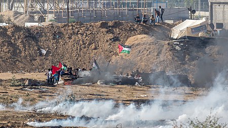
Bureij

Bureij (Arabic: البريج) is a Palestinian refugee camp located in the central Gaza Strip east of the Salah al-Din Road in the Deir al-Balah Governorate. The camp's total land area is 529 dunums and in 2017, it had a population of 28,024 with 28,770 registered refugees. The Palestinian Central Bureau of Statistics (PCBS) 2017 census listed a population of 15,491 in the surrounding Bureij municipality apart from the camp population.The camp was established in 1949 with a population of 13,000 Palestinians from the broader Gaza area. A small percentage of the refugees were housed in the British army barracks but the bulk of them were housed in tents. The UNRWA built concrete homes in 1950 to replace the tents. Most of the refugees today, like those in most camps in the Gaza Strip today, live in densely populated buildings. The camp does not have a sewage system and most waste accumulates in the Wadi Gaza, a stream north of the camp, and as a result poses a health hazard. Most of the camp's water comes from an Israeli water company.Bureij has six primary and two secondary schools with a population of 9,306 pupils at the end of 2004. All schools are operated by the UNRWA.
Excerpt from the Wikipedia article Bureij (License: CC BY-SA 3.0, Authors, Images).Bureij
Geographical coordinates (GPS) Address Nearby Places Show on map
Geographical coordinates (GPS)
| Latitude | Longitude |
|---|---|
| N 31.439530555556 ° | E 34.402938888889 ° |
Address
, Bureij Refugee Camp
Palestinian Territories
Open on Google Maps


