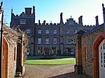
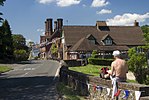
Shere is a village in the Guildford district of Surrey, England 4.8 miles (7.7 km) east south-east of Guildford and 5.4 miles (8.7 km) west of Dorking, centrally bypassed by the A25. It is a small still partly agricultural village chiefly set in the wooded 'Vale of Holmesdale' between the North Downs and Greensand Ridge with many traditional English features. It has a central cluster of old village houses, shops including a blacksmith and trekking shop, tea house, art gallery, two pubs and a Norman church. Shere has a CofE infant and nursery school with 'outstanding academic results' (Ofsted 2015) catering for 2- to 7-year-old children which serves the village and surrounding villages and towns, and a museum which opens most afternoons at weekends.
The River Tillingbourne runs through the centre of the village. More than four-fifths of homes are in the central area covering 3.11 square kilometres (1.20 sq mi); the northern area of Shere on the North Downs without any named hamlets, including the public hilltop park of Newlands Corner, covers 6.77 square kilometres (2.61 sq mi).
Shere is also a civil parish, extending to the east and south into hamlets founded in the early Middle Ages which officially, in the 19th century, were consolidated into three villages. These are Gomshall, Holmbury St. Mary and Peaslake. This larger entity has a total population of 3,359 and area of 24.5 square kilometres (9.5 sq mi) (as at the 2011 census).


