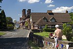
Combe Bottom
Sites of Special Scientific Interest in Surrey

Combe Bottom is a 42.1-hectare (104-acre) biological Site of Special Scientific Interest north of Shere in Surrey. It is designated a Local Nature Reserve called Shere Woodlands, and is managed by the Surrey Wildlife Trust.This site on a slope of the North Downs is mainly woodland and scrub, with a small area of unimproved chalk grassland. The woodland is dominated by beech and yew. There is a wide variety of bryophytes, including the rare moss Herzogiella seligeri.There is access from Staple Lane and Combe Lane.
Excerpt from the Wikipedia article Combe Bottom (License: CC BY-SA 3.0, Authors, Images).Combe Bottom
Combe Lane,
Geographical coordinates (GPS) Address Nearby Places Show on map
Geographical coordinates (GPS)
| Latitude | Longitude |
|---|---|
| N 51.229 ° | E -0.47 ° |
Address
Combe Lane
Combe Lane
GU5 9TD
England, United Kingdom
Open on Google Maps


