Salem Fork, North Carolina
Surry County, North Carolina geography stubsUnincorporated communities in North CarolinaUnincorporated communities in Surry County, North CarolinaUse mdy dates from July 2023

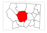
Salem Fork is an unincorporated community in central Surry County, North Carolina, United States. The community is centered on the junction of Zephyr Road (SR 1001) and Interstate 77. Prominent landmarks in the community include Salem Fork Baptist Church and Salem Fork Church of Christ (Disciples of Christ). A growing commercial area is developing in the center of the community, including hotels and planned shops. This is due to the increased traffic volume from the interstate to the nearby Shelton Vineyards attraction and the expansion of some municipal services from the nearby town of Dobson.
Excerpt from the Wikipedia article Salem Fork, North Carolina (License: CC BY-SA 3.0, Authors, Images).Salem Fork, North Carolina
I 77,
Geographical coordinates (GPS) Address Nearby Places Show on map
Geographical coordinates (GPS)
| Latitude | Longitude |
|---|---|
| N 36.394 ° | E -80.787 ° |
Address
I 77
North Carolina, United States
Open on Google Maps


