place

Haggetts Pond

Buildings and structures in Andover, MassachusettsLakes of Essex County, MassachusettsProtected areas of Essex County, MassachusettsReservoirs in Massachusetts
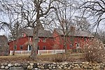
Haggetts Pond view, March 2019

Haggetts Pond is the reservoir for the town of Andover, Massachusetts, United States. It is located in the western part of the town and also lends its name to a road. The Merrimack River is connected to the pond to add volume to the reservoir. It is bordered by Route 133 on the south. Not far to the northwest is Interstate 495; to the northeast is Interstate 93. Permissible activities include walking, hiking, jogging biking and fishing. Only registered rowboats are allowed on the reservoir and fishing must be done from either the shoreline or a rowboat (no hip waders). Canoeing or kayaking, windsurfing, sailing, ice skating and ice fishing are prohibited. Swimming, bathing, wading and pets in the water are also prohibited. Hiking trails, some converted out of a former railway (the Lowell and Lawrence Railroad), encircle the pond. The Pond also gives its name to a road (Haggetts Pond Road) that starts to the west of the pond itself. Haggetts Pond Road transverses Route 133, but the vast majority of its length is on the side north of the pond. (Of the 245 houses on Haggetts Pond Road, 240 of them are on the north side.)

Excerpt from the Wikipedia article Haggetts Pond (License: CC BY-SA 3.0, Authors, Images).

Haggetts Pond
Lowell & Lawrence Railroad,

Geographical coordinates (GPS) Address Nearby Places
placeShow on map

Wikipedia: Haggetts PondContinue reading on Wikipedia

Geographical coordinates (GPS)

Latitude Longitude
N 42.6485564 ° E -71.1996585 °
placeShow on map

Address

Lowell & Lawrence Railroad

Massachusetts, United States
mapOpen on Google Maps

Haggetts Pond view, March 2019
Share experience

Nearby Places

West Parish Center District

The West Parish Center District encompasses the social and religious center of the part of Andover, Massachusetts, that is located west of the Shawsheen River. It is mostly spread along Lowell Street (Massachusetts Route 133) on either side of a major intersection with four other roads: Shawsheen Road, Reservation Road, Beacon Street, and High Plain Road. The centerpiece of the district is the 1826 West Parish Church, which is the oldest church standing in Andover. It is an elegant Federal style granite structure topped with a wooden steeple, added in 1863. The roof is made of Spanish tile, which was probably part of changes made around 1908. Opposite the church on the south side of the common is the West Parish Cemetery, which began as a small burying ground in the 1790s, and was substantially enlarged and restyled (including the addition of the large arch at its main entrance) in the early 1900s.In addition to the church, common, and cemetery, a number of period houses line Lowell Street and the nearby streets. Most of them were built between 1780 and 1830, and are in Federal or Greek Revival styles. One notable exception is the C. A. Holt House at 202 Shawsheen Road, which is a fine Queen Anne style Victorian. The newest house in the district, 181 Lowell Street, is a Bungalow-style 1-1/2 story house built about 1920, and the oldest is an early Federal style house built about 1780, at 173 Lowell.The district was listed on the National Register of Historic Places in 1982.