Rousdon

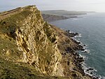
Rousdon is a village in East Devon off the A3052 road between Colyford and Lyme Regis in Dorset. The clifftop but well set back village developed as the main settlement, within its ecclesiastical parish Combpyne, which otherwise has only a few houses by its church and scattered farms. It did so north of Sir Henry Peek's grand house, billiard house and separate stable courtyard chiefly in the early 19th century. A boarding school called Allhallows moved there from Honiton in 1937 and closed in 1998. Adjoining the small fields to the south are the coastal cliffs which lie above the Axmouth to Lyme Regis Undercliff Nature Reserve that forms part of the Jurassic Coast World Heritage Site. It is a green wilderness littoral forest strip with many rugged parts and ruins of farmhouses formed largely from a landslip (major cliff erosion) in 1839. The South West Coast Path crosses it for some miles. No public right of way links Rousdon directly, nor any adjacent area, to the path below along Charton Bay which links the foot of the Axe estuary south of Axmouth (at the western edge of Seaton Seaton to Ware, immediately south-west of Lyme Regis, on the Dorset border.
Excerpt from the Wikipedia article Rousdon (License: CC BY-SA 3.0, Authors, Images).Rousdon
Combpyne Lane, East Devon Combpyne Rousdon
Geographical coordinates (GPS) Address Nearby Places Show on map
Geographical coordinates (GPS)
| Latitude | Longitude |
|---|---|
| N 50.71671 ° | E -2.99868 ° |
Address
Combpyne Lane
Combpyne Lane
DT7 3XZ East Devon, Combpyne Rousdon
England, United Kingdom
Open on Google Maps


