place

Combpyne railway station

Beeching closures in EnglandDisused railway stations in DevonFormer London and South Western Railway stationsPages with no open date in Infobox stationRailway stations in Great Britain closed in 1965
Railway stations in Great Britain opened in 1903South West England railway station stubsUse British English from March 2018

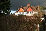
Combpyne railway station was the intermediate station on the Lyme Regis branch line in East Devon, England. Serving the village of Combpyne, it was sited high on the sharp bend that changed the course of the line from south to an easterly direction.

Excerpt from the Wikipedia article Combpyne railway station (License: CC BY-SA 3.0, Authors).

Combpyne railway station
Lidyates Lane, East Devon Combpyne Rousdon

Geographical coordinates (GPS) Address External links Nearby Places
placeShow on map

Wikipedia: Combpyne railway stationContinue reading on Wikipedia

Geographical coordinates (GPS)

Latitude Longitude
N 50.7259 ° E -2.9927 °
placeShow on map

Address

Combpyne

Lidyates Lane
DT7 3RF East Devon, Combpyne Rousdon
England, United Kingdom
mapOpen on Google Maps

linkWikiData (Q5150951)
linkOpenStreetMap (8278364792)

Share experience

Nearby Places

Jurassic Coast
Jurassic Coast

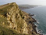
The Jurassic Coast is a World Heritage Site on the English Channel coast of southern England. It stretches from Exmouth in East Devon to Studland Bay in Dorset, a distance of about 96 miles (154 km), and was inscribed on the World Heritage List in mid-December 2001.The site spans 185 million years of geological history, coastal erosion having exposed an almost continuous sequence of rock formation covering the Triassic, Jurassic and Cretaceous periods. At different times, this area has been desert, shallow tropical sea and marsh, and the fossilised remains of the various creatures that lived here have been preserved in the rocks. Natural features seen on this stretch of coast include arches, pinnacles and stack rocks. In some places the sea has broken through resistant rocks to produce coves with restricted entrances and, in one place, the Isle of Portland is connected to the land by a barrier beach. In some parts of the coast, landslides are common. These have exposed a wide range of fossils, the different rock types each having its own typical fauna and flora, thus providing evidence of how animals and plants evolved in this region. The area around Lulworth Cove contains a fossil forest, and 71 different rock strata have been identified at Lyme Regis, each with its own species of ammonite. The fossil collector Mary Anning lived here and her major discoveries of marine reptiles and other fossils were made at a time when the study of palaeontology was just starting to develop. The Charmouth Heritage Coast Centre provides information on the heritage coast, and the whole length of the site can be visited via the South West Coast Path.

Axmouth to Lyme Regis Undercliffs

The Axmouth to Lyme Regis Undercliffs, also often referred to in the singular as the Undercliff, is a 5-mile (8.0 km) long landscape feature, National Nature Reserve and Site of Special Scientific Interest that connects Seaton and Axmouth with Lyme Regis on the south-west coast of England. Like its namesake on the Isle of Wight, this feature arose as a result of landslips, where a slump of harder strata over softer clay gave rise to irregular landscapes of peaks, gullies and slipped blocks. Because of the resulting difficulty of access and change of land use, the undercliff has become densely vegetated, and has become a rare and unusual habitat for plants and birds.From west to east, the undercliff forms part of the civil parishes of Axmouth, Combpyne Rousdon and Uplyme, all in the county of Devon. At its eastern end, it also stretches a short way into the town of Lyme Regis, in the county of Dorset. It forms part of the Jurassic Coast World Heritage Site and the South West Coast Path runs through it. The footpath stretches for 7 – 8 miles (13 km) and is not accessible except at each end. It is not permitted to leave the path due to the nature reserve status and the dangerous terrain.Some of the landslips that created the undercliff took place within historical record. Recorded slips took place in 1775, 1828, 1839 (the Great Slip) and 1840. The 1839 slip was especially well-documented since the geologists William Buckland and William Daniel Conybeare were in the area to survey it. A large tract of land below Bindon Manor and Dowlands Farm slipped, creating the features now called Goat Island and the Chasm. It took with it an area of sown wheatfield which remained sufficiently undamaged for the wheat to be harvested in 1840, when the slip was a popular visitor attraction.The undercliff was formerly open rough pasture, grazed by sheep and rabbits, including features such as Donkey Green (an area of turf used for picnics and sports), Landslip Cottage (which used to sell teas to visitors), and Chapel Rock (where, according to tradition, Tudor religious dissenters met). However, it became heavily overgrown in the 20th century following the cessation of sheep farming and the decline in rabbits due to myxomatosis, and access is now difficult, the terrain being treacherous due to its unstable cliffs, deep gullies and dense undergrowth.Sabine Baring-Gould's 1900 novel Winefred, a story of the chalk cliffs is set in the Undercliff area, with the Great Slip as its climax. The undercliff was also one of the settings for the novel The French Lieutenant's Woman and a location for its film adaptation.