Gurnard, Isle of Wight

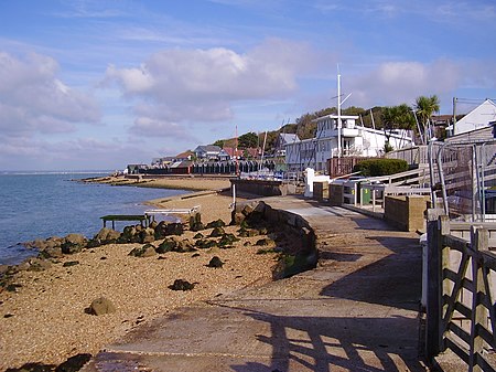
Gurnard is a village and civil parish on the Isle of Wight, two miles to the west of Cowes. Gurnard sits on the edge of Gurnard Bay, enjoyed by the Gurnard Sailing Club. Gurnard's main street features a pub (Portland Inn), a few shops and a few houses. The west end of the beach is Gurnard Marsh and a stream called "The Luck" which discharges into the Solent. A fortification known as Gurnard Fort was built on a headland west of Gurnard Marsh about 1600. The land was eroded, however, and all traces disappeared until an archaeological excavation of a Roman villa in 1864 uncovered traces of Gurnard Fort as well.Transport is provided by Southern Vectis route 32 to and from Cowes, and route 1 to Cowes and Newport, Isle of Wight.
Excerpt from the Wikipedia article Gurnard, Isle of Wight (License: CC BY-SA 3.0, Authors, Images).Gurnard, Isle of Wight
Worsley Road,
Geographical coordinates (GPS) Address Nearby Places Show on map
Geographical coordinates (GPS)
| Latitude | Longitude |
|---|---|
| N 50.755 ° | E -1.321 ° |
Address
Portland Inn
Worsley Road 2
PO31 8JN , Gurnard
England, United Kingdom
Open on Google Maps


