place

Bethlehem, Connecticut

Bethlehem, ConnecticutPopulated places established in 1787Towns in ConnecticutTowns in Litchfield County, ConnecticutTowns in Naugatuck Valley Planning Region, Connecticut
Towns in the New York metropolitan areaUse mdy dates from July 2023
BethlehemCT BethlehemGreenHD 2

Bethlehem is a town in Litchfield County, Connecticut, United States. The population was 3,385 at the 2020 census, down from 3,607 at the 2010 census. The town is part of the Naugatuck Valley Planning Region. The town center is a historic district and a census-designated place (CDP). The town's name has prompted thousands of visitors each December to mail their Christmas cards at the renowned local post office, situated at 34 East Street, in order to get a "Bethlehem" postmark. The post office also has nearly 100 Christmas-related stamps for customers to decorate their envelopes during the holiday season.Bethlehem is one of the two towns in Litchfield County served by the area code 203/area code 475 overlay. The other is the town of Woodbury.

Excerpt from the Wikipedia article Bethlehem, Connecticut (License: CC BY-SA 3.0, Authors, Images).

Bethlehem, Connecticut
Main Street South,

Geographical coordinates (GPS) Address Nearby Places
placeShow on map

Wikipedia: Bethlehem, ConnecticutContinue reading on Wikipedia

Geographical coordinates (GPS)

Latitude Longitude
N 41.639166666667 ° E -73.208611111111 °
placeShow on map

Address

Main Street South 7
06751
United States
mapOpen on Google Maps

BethlehemCT BethlehemGreenHD 2
Share experience

Nearby Places

Bethlehem Green Historic District

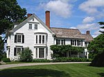
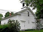
The Bethlehem Green Historic District is a historic district in the center of the town of Bethlehem, Connecticut, listed on the National Register of Historic Places in 1982 for the architectural significance of the houses around the town green. The historic district includes the green and 63 contributing properties over an area of 55 acres (22 ha).The Bethlehem Green is a triangular park bounded on the east by Route 61 (Main Street), on the north by Route 132 (West Road), and on the west by the street called "The Green". Within the green are five tablet monuments and a large green boulder monument listing names of Bethlehem residents who served in various wars from the American Revolution to World War II. A flagpole lies opposite the monuments. Maple trees have been planted around the perimeter of the green, and a large evergreen tree (decorated as a Christmas tree in winter) is located in the center of the green.Historic buildings around the green include the Congregational church (1790), the townhouse (1839), the Episcopal Church (1832), two 18th-century taverns now used as residences, a general store built on the site of a former store built in the 19th century, and a former school building.The district is also the site of the Bellamy-Ferriday House and Garden (Joseph Bellamy House), which is listed separately on the National Register of Historic Places, and of the original meetinghouse of Bethlehem built in 1767. The original meetinghouse no longer stands but its site is marked by a granite obelisk.