Snake Pass

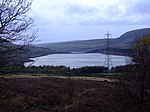
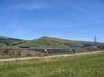
Snake Pass is a hill pass in the Derbyshire section of the Peak District, crossing the Pennines between Glossop and the Ladybower Reservoir at Ashopton. The road was engineered by Thomas Telford and opened in 1821. The pass carries the A57 road between Manchester and Sheffield, but it is no longer the main signposted route between those two cities, with traffic instead directed through the Woodhead Pass to the north. Like several other roads that cross the Pennines, Snake Pass has a poor accident record compared with roads in the UK generally, although more favourable compared with other roads in the area. It is regularly closed in winter because of snow, and has seen several longer-term closures owing to subsidence following heavy rain. The road remains a popular route for tourists and motorcycles, however, and sections have been used for semi-professional cycling races such as the Tour of Britain.
Excerpt from the Wikipedia article Snake Pass (License: CC BY-SA 3.0, Authors, Images).Snake Pass
Snake Road, High Peak
Geographical coordinates (GPS) Address Nearby Places Show on map
Geographical coordinates (GPS)
| Latitude | Longitude |
|---|---|
| N 53.4329 ° | E -1.8689 ° |
Address
Snake Road
Snake Road
S33 0BJ High Peak
England, United Kingdom
Open on Google Maps


