place

Sherman, Connecticut

Sherman, ConnecticutTowns in ConnecticutTowns in Fairfield County, ConnecticutTowns in the New York metropolitan area
Fairfield County Connecticut incorporated and unincorporated areas Sherman highlighted

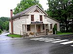
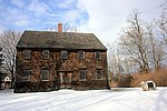
Sherman is the northernmost and least populous town of Fairfield County, Connecticut, United States. The population was 3,527 at the 2020 census. The town was formed in 1802 from the northern part of New Fairfield. It is named for Roger Sherman, the only person who signed all four founding documents of the United States of America. He also had a cobblers shop in the north end of town which has been reconstructed behind the Northrup House in the center of town. Sherman has been named "Best Small Town in Connecticut" three times by Connecticut Magazine. The Appalachian Trail goes through the northern end of Sherman. Part of Squantz Pond is in the town. Sherman is a popular weekend retreat for New York City residents, with about a third of its residents weekenders. The town is located 62 miles (100 km) northeast of New York City, making it part of the New York metropolitan area.Sherman has one area on the National Register of Historic Places: the Sherman Historic District, bounded roughly by the intersection of Old Greenswood Road and Route 37, northeast past the intersection of Route 37 East and Route 39 North and Sawmill Road. The district was added to the National Register on August 31, 1991. Sherman is the only town in Fairfield County in the 860 area code; the remainder of the county is served by the area code 203/area code 475 overlay.

Excerpt from the Wikipedia article Sherman, Connecticut (License: CC BY-SA 3.0, Authors, Images).

Sherman, Connecticut
Gaylordsville Road,

Geographical coordinates (GPS) Address Nearby Places
placeShow on map

Wikipedia: Sherman, ConnecticutContinue reading on Wikipedia

Geographical coordinates (GPS)

Latitude Longitude
N 41.583333333333 ° E -73.5 °
placeShow on map

Address

Gaylordsville Road 17
06784
Connecticut, United States
mapOpen on Google Maps

Fairfield County Connecticut incorporated and unincorporated areas Sherman highlighted
Share experience

Nearby Places

Oblong Friends Meeting House

The Oblong Friends Meeting House is a mid-18th century Friends Meeting House of the Religious Society of Friends in the hamlet of Quaker Hill, in the town of Pawling, Dutchess County, New York, United States listed in the National Register of Historic Places since 1973. Members of the Religious Society of Friends settled on Quaker Hill in the 1730s and sought permission to establish a meeting and build a meeting house in 1740. The first meeting house was constructed across from the present building in 1742, but as membership grew, this building became too small and in 1763, the Yearly Meeting decided to erect "a framed house of timber, the dimensions to be 45 feet (14 m) long, 40 feet (12 m) wide and 15 feet (4.6 m) stud to admit of galleries." This new house was built in 1764 and is the structure that has remained on the site since. Benjamin Sherman, carpenter of Quaker Hill, is credited with building the new Hicksite Meeting House in 1764.In 1767, the question was raised in the meeting house whether it was "consistent with the Christian spirit to hold a person in slavery". After years of discussion, the question was answered in 1776 by the resolution that meetings were not to accept financial contributions or services from members owning slaves. During the American Revolutionary War a portion of the Continental Army camped in the nearby hills, both during the fall of 1778 and the winter of 1779. The meeting house was commandeered by General Washington's officers to be used as a military hospital.In 1828, the New York Meeting of the Society of Friends split into the Orthodox and Hicksite Societies of Friends. From then on, the Hicksites used the Meeting House, and the Orthodox Society, which had fewer members, built its own meeting house in 1831, just 200 feet (61 m) to the northwest. The latter building was later converted into a private residence. Membership in the area's Society of Friends declined in the course of the 19th century and the meetings were "laid down" in 1885. The property was acquired by the Historical Society of Quaker Hill and Pawling in 1936 which has preserved the building since then. The building is a two-story building, five bays wide and two bays deep. Inside the shingled structure, there are sliding panels which divide the men's and women's portions of the building. As with most meeting houses, there are two front doors, one for each gender.

Quaker Hill, New York

Quaker Hill is a hamlet in the town of Pawling in Dutchess County, New York, United States. The community shares its name with the twelve-mile-long ridge on which it is located; the ridge is located near the Connecticut state line. Quaker Hill is in the southern portion of the area known as the "Oblong" that was designated by the Treaty of Dover in 1731, and "known from pre-Revolutionary times as Quaker Hill". In colonial times, Quaker Hill separated "the English [settlers] of New England and the Hudson Valley Dutch population."It is the location of the Oblong Friends Meetinghouse, built in 1764. According to historian Richard Norton Smith, "the first antislavery protest meeting in North America convened" in 1767 in the Oblong Friends Meetinghouse. One addition to the Oblong Friends Meetinghouse, the Akin Free Library, is also listed on the National Register of Historic Places.In 1926 the prominent radio broadcaster and reporter Lowell Thomas, who had made Lawrence of Arabia famous, purchased a 350-acre farm on Quaker Hill, which he later enlarged to 2,000 acres and named "Clover Brook Farm." Thomas developed Quaker Hill into a well-known haven for numerous successful business, news media, political, and legal figures. To keep the rural flavor of the area, Thomas forbade the building of shopping centers, large businesses or factories, or extensive housing developments on Quaker Hill while he lived there. Instead, individual lots and existing farms were sold to families who met with his approval. Approximately one hundred families settled there, usually under the guidance of Thomas and his real-estate agents. Among the prominent figures who lived on Quaker Hill at one time or another from the 1930s to the 1970s were New York Governor and two-time Republican presidential nominee Thomas E. Dewey, the Reverend Norman Vincent Peale, famed CBS News journalist Edward R. Murrow, and Casey Hogate, the publisher of The Wall Street Journal. In 1953, Thomas moved to a larger estate he built on Quaker Hill called Hammersley Hill.Thomas also transformed Quaker Hill while he was in residence there. He persuaded professional golfer Gene Sarazen and golf course architect Robert Trent Jones into building a country club and golf course on the northern part of the hill, and he built ski slopes and ski tows on the hill. Thomas held regular Saturday evening parties and dances for the residents of Quaker Hill at a community center he built called the Barn. In its fireplace, he "installed stones from the Great Pyramid of Cheops, the Parthenon, St. Peter's Cathedral, China's Great Wall, and Mount Vernon." He transformed a stone library on the hill, called Akin Hall, into a "nondenominational place of worship in Christopher Wren style." An avid horseman, he also established more than 200 miles of bridle paths that stretched across Quaker Hill.The community has been studied extensively. It was the subject of a Columbia University political science Ph.D. dissertation completed in 1907 by Warren Hugh Wilson, an early pioneering contributor to rural sociology.