Dunsandel

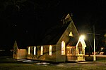
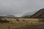
Dunsandel is a small rural town in the Canterbury region of the South Island, New Zealand. The town is located on the Canterbury Plains just south of the Selwyn River / Waikirikiri and about 40 km south of Christchurch. Dunsandel is a junction town on SH1, halfway between Christchurch and Ashburton, with roads leading to Leeston, Southbridge and Hororata. The town provides an important refreshment stop for main road travellers with eateries and coffee shops, as well as acting as a support town for the rural hinterland. The town was established to serve the local farming community which includes dairy, sheep and cropping and continues providing veterinary, transport and vehicle repair services. It was named after Dunsandle Castle, the home of Robert Daly, who had owned the land on which the town as established. It has one primary school for approximately 150 children. The town is the home to the Dunsandel Cricket Club. The club's 'A' team has a reputation as one of the premier teams in the Ellesmere district.
Excerpt from the Wikipedia article Dunsandel (License: CC BY-SA 3.0, Authors, Images).Dunsandel
Main South Road,
Geographical coordinates (GPS) Address Nearby Places Show on map
 Continue reading on Wikipedia
 Geographical coordinates (GPS)
| Latitude | Longitude |
|---|---|
| N -43.660555555556 ° | E 172.19277777778 ° |
Address
Main South Road 3418
7682
Canterbury, New Zealand
Open on Google Maps