place

Dryburgh Abbey

1150 establishments in Scotland15th-century church buildings in ScotlandBuildings and structures in the Scottish BordersCategory A listed buildings in the Scottish BordersChristian monasteries established in the 12th century
Historic Scotland properties in the Scottish BordersListed monasteries in ScotlandMonasteries dissolved under the Scottish ReformationPremonstratensian monasteries in ScotlandReligious organizations established in the 1150sRuined abbeys in the Scottish BordersScheduled Ancient Monuments in the Scottish Borders
Dryburgh Abbey, 2004

Dryburgh Abbey, near Dryburgh on the banks of the River Tweed in the Scottish Borders, was nominally founded on 10 November (Martinmas) 1150 in an agreement between Hugh de Morville, Constable of Scotland, and the Premonstratensian canons regular from Alnwick Abbey in Northumberland. The arrival of the canons along with their first abbot, Roger, took place on 13 December 1152.It was burned by English troops in 1322, after which it was restored only to be again burned by Richard II in 1385, but it flourished in the fifteenth century. It was finally destroyed in 1544, briefly surviving until the Scottish Reformation, when it was given to the Earl of Mar by James VI of Scotland. It is now a designated scheduled monument and the surrounding landscape is included in the Inventory of Gardens and Designed Landscapes in Scotland.David Erskine, 11th Earl of Buchan bought the land in 1786. Sir Walter Scott and Douglas Haig are buried in its grounds. Their respective tomb and headstone, along with other memorials, are collectively designated a Category A listed building.

Excerpt from the Wikipedia article Dryburgh Abbey (License: CC BY-SA 3.0, Authors, Images).

Geographical coordinates (GPS)

Latitude Longitude
N 55.577083333333 ° E -2.6494444444444 °
placeShow on map

Address

Dryburgh Abbey

B6356
TD6 0RQ
Scotland, United Kingdom
mapOpen on Google Maps

Dryburgh Abbey, 2004
Share experience

Nearby Places

Dryburgh Abbey Bridge

Dryburgh Abbey Bridge was a cable-stayed footbridge of significant historical interest erected near Dryburgh Abbey, in the Borders of Scotland. It connected the villages of Dryburgh and St. Boswells (part of a ribbon of settlements, including Newtown St. Boswells), across the River Tweed. A crossing had existed here for centuries, originally with a ferry service. The bridge had been commissioned by David Stewart Erskine, 11th Earl of Buchan, an eccentric Scottish aristocrat who later died in Dryburgh. It was 79 metres (259 ft) long. At the time, the cable-stayed type of bridge was undergoing a period of rapid growth in popularity. The Earl opened the completed bridge on 1 August 1817, but in January 1818 it collapsed. One of the designers, Thomas Smith, said of the collapse that due to "high wind increasing to [a] perfect hurricane, it carried off [the] chain bridge, leaving only the fastenings and supports, the work of half a year, demolished in an hour...." After a redesign, a replacement was built, but this too collapsed in 1838, by which time the Earl had been dead for several years. The 1818 collapse, together with that of a slightly shorter bridge across the Saale River in Germany in 1824, caused the reputation of cable-stayed bridges to decline rapidly, and despite a history dating back to the 17th century, the design was almost completely abandoned for over a century, with suspended-deck suspension bridges gaining favour. Later research in the 1930s, and experience with reconstruction after the Second World War, demonstrated that with sound design, cable-stayed bridges are not without their advantages, and the first modern design, the Strömsund Bridge in Sweden, was completed in 1955. Very shortly after the 1818 collapse (between 1819 and 1820) another bridge, the Union Bridge, was built some 40 kilometres (25 mi) downstream. It was an iron suspended-deck suspension bridge, the longest in the world upon its completion. A third Dryburgh Suspension Bridge was built in 1872 to replace the 1838 loss.

Scott's View
Scott's View

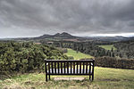
Scott's View is a viewpoint in the Scottish Borders, overlooking the valley of the River Tweed, which is reputed to be one of the favourite views of Sir Walter Scott. The viewpoint can be located directly from a minor road leading south from Earlston just off the A68 and by travelling north from the village of St. Boswells up the slope of Bemersyde Hill. The view is around 3 miles east of Melrose. The view is to the west, and is dominated by the three peaks of the Eildon Hills. To the south west the view is extensive and open, taking in rolling farmland beyond the village of Newtown St Boswells. Immediately below the viewer is a meander of the Tweed itself, enclosing a peninsula of land on which stood the ancient monastery of Old Melrose, referred to in Bede, where St Boisil welcomed the young St Cuthbert to train following his vision of St Aidan of Lindisfarne in 651ad. Often a fly fisherman can be seen fishing the river. To the north west the viewer looks along the Tweed valley to Melrose. Towards the north-west the viewer can see the Black Hill, a Marilyn near Earlston. Immediately below the view point, on the cliffs above the River Tweed, is one of the few remaining fragments of semi-natural woodland in the area. The oak trees that remain are the descendants of trees used to supply wood for the manufacture of coffins in the area. According to a popular story, Sir Walter Scott stopped at this point so often on the way to his home at Abbotsford, that his horses would halt without command. After his death in 1832, his funeral cortège passed this way en route to his burial at Dryburgh Abbey, and his horses stopped at his favourite view to allow their master a last look at the Borders landscape. In fact, although the funeral procession did pass this way, the halt was due to 'some accident'. The William Wallace Statue in the grounds of Bemersyde House is a larger than life statue of Scotland's hero, Sir William Wallace.