RAF Beaulieu

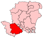
Royal Air Force Beaulieu or more simply RAF Beaulieu is a former Royal Air Force station in the New Forest, Hampshire, England. It was also known as Beaulieu airfield, Beaulieu aerodrome and USAAF Station AAF 408. It is located on Hatchet Moor 1 mile (2 km) west of the village of East Boldre, about 2 miles (3 km) west-southwest of the village of Beaulieu and 4 miles (6 km) north-east of Lymington. During the First World War there was a Royal Flying Corps training airfield, RFC Beaulieu, at East Boldre that was closed in 1919 The new RAF Beaulieu, opened on 8 August 1942, was built on the opposite side of the road. It was used by both the Royal Air Force and then later United States Army Air Forces. During the war it was used as a bomber and fighter airfield. After the war, it was used for experimental work before it was closed in 1959. Today the remains of the airfield are on heathland managed by the Forestry Commission. Areas of the old airfield are now designated as a flying area for model aircraft.
Excerpt from the Wikipedia article RAF Beaulieu (License: CC BY-SA 3.0, Authors, Images).RAF Beaulieu
Beaulieu Road, New Forest East Boldre
Geographical coordinates (GPS) Address Nearby Places Show on map
Geographical coordinates (GPS)
| Latitude | Longitude |
|---|---|
| N 50.8075 ° | E -1.5047222222222 ° |
Address
Beaulieu Road
SO42 7QL New Forest, East Boldre
England, United Kingdom
Open on Google Maps


