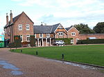
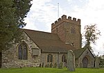
Borough of Runnymede

The Borough of Runnymede is a local government district with borough status in the English county of Surrey. It is a very prosperous part of the London commuter belt, with some of the most expensive housing in the United Kingdom outside central London, such as the Wentworth Estate. Runnymede is entirely unparished and is largely built-up. The borough's council is based in Addlestone; other settlements include Chertsey, Egham, Egham Hythe, Virginia Water, Englefield Green and Thorpe. At the 2011 Census, the population of the borough was 80,510. As of May 2023 it is in no overall control, with the Conservatives relying on the Ottershaw Independents to form an administration, with a supply and confidence deal.The borough was formed in 1974 under the Local Government Act 1972 by the merger of the Chertsey and Egham Urban Districts, both of which had been created in 1894. It is named after Runnymede, a water meadow on the banks of the River Thames, near Egham. Runnymede is connected with the sealing of Magna Carta by King John in 1215 and is the site of several significant monuments. Runnymede borders the boroughs of Spelthorne, Elmbridge, Woking and Surrey Heath, as well as the Royal Borough of Windsor and Maidenhead in Berkshire. The M25 motorway runs through Runnymede from south to north, with junctions at Chertsey and Egham, while train services in the borough are provided by South Western Railway on the Waterloo–Reading line and the Chertsey branch line.
Excerpt from the Wikipedia article Borough of Runnymede (License: CC BY-SA 3.0, Authors, Images).Borough of Runnymede
Lyne Crossing Road, Borough of Runnymede
Geographical coordinates (GPS) Address Nearby Places Show on map
Geographical coordinates (GPS)
| Latitude | Longitude |
|---|---|
| N 51.395 ° | E -0.541 ° |
Address
Lyne Crossing Road
Lyne Crossing Road
KT16 0AS Borough of Runnymede
England, United Kingdom
Open on Google Maps


