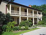
Stoney Creek, Ontario

Stoney Creek is a community in the city of Hamilton in the Canadian province of Ontario. It was officially a city from 1984 to 2001, when it was amalgamated with the rest of the cities of the Regional Municipality of Hamilton–Wentworth. The community of Stoney Creek is located on the south shore of western Lake Ontario, east of downtown Hamilton, into which feed the watercourses of Stoney Creek as well as several other minor streams. The historic area, known as the "Old Town", is below the Niagara Escarpment. Stoney Creek experienced an increase in residential growth, particularly in the lower city in the 1970s and 1980s, and in the west mountain in the 1990s and 2000s, but most of the land mass of Stoney Creek remains agricultural. The communities of Elfrida, Fruitland, Tapleytown, Tweedside, Vinemount, and Winona serve as distinct reminders of the agricultural legacy of Stoney Creek and Saltfleet Township.
Excerpt from the Wikipedia article Stoney Creek, Ontario (License: CC BY-SA 3.0, Authors, Images).Stoney Creek, Ontario
Loma Drive, Hamilton Stoney Creek
Geographical coordinates (GPS) Address Nearby Places Show on map
Geographical coordinates (GPS)
| Latitude | Longitude |
|---|---|
| N 43.216666666667 ° | E -79.75 ° |
Address
Loma Drive 11
L8G 3L5 Hamilton, Stoney Creek
Ontario, Canada
Open on Google Maps


