place

Chiddingstone Castle

Art museums and galleries in KentBuildings and structures in Sevenoaks DistrictCastles in KentEgyptological collections in EnglandGardens in Kent
Grade II* listed buildings in KentHistoric house museums in KentHouses in KentMock castles in EnglandMuseums in Sevenoaks DistrictStreatfeild familyUse British English from February 2023
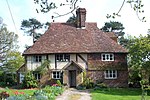
Chiddingstone Castle gate

Chiddingstone Castle is situated in the village of Chiddingstone, near Edenbridge, Kent, England, 35 miles (56 kilometres) south-southeast of London and in the upper valley of the River Medway. The castle was built by the Streatfeild family and served as their seat from the early 16th century until the beginning of the 20th century when the family left the castle. The Streatfeilds sold the castle to Lord Astor in 1938. Since 1977, the castle and its 35 acres (14 hectares) of grounds have been held in trust for the nation by the Denys Eyre Bower Bequest, and both are open to the public. Much of the current structure dates from the early 19th century, but incorporates elements of the earlier buildings on the same site.

Excerpt from the Wikipedia article Chiddingstone Castle (License: CC BY-SA 3.0, Authors, Images).

Chiddingstone Castle
Chiddingstone Road,

Geographical coordinates (GPS) Address Nearby Places
placeShow on map

Wikipedia: Chiddingstone CastleContinue reading on Wikipedia

Geographical coordinates (GPS)

Latitude Longitude
N 51.1858 ° E 0.1424 °
placeShow on map

Address

Chiddingstone Road
TN8 7AB
England, United Kingdom
mapOpen on Google Maps

Chiddingstone Castle gate
Share experience

Nearby Places

Somerden Hundred
Somerden Hundred

Somerden was a hundred, a historical land division, in the county of Kent, England. It occupied the southwest corner of Kent, in the southern part of the Lathe of Sutton-at-Hone, in the west division of Kent. The hundred was one of the last to be created in Kent, unlike the majority of Kent hundreds, it was not formally constituted in the Domesday Book of 1086, but came into being sometime after. Today the area is mostly rural and located in the southern part of the Sevenoaks District, south of Sevenoaks and west of Tonbridge. Somerden Hundred was approximately 7.5 mi (12.1 km) wide east to west, and 5.5 mi (8.9 km) long north to south, and had a small exclave about 1 mi (1.6 km) out from its south east corner. In the 1831 census Somerden was recorded as having an area of 13,650 acres (55 km2). The population in that census was recorded as 3,924, of which 2,078 were male and 1,846 were female, who belonged to 734 families living in 567 houses.In the later years of its existence the Oxted Line and Redhill to Tonbridge Line railway lines were constructed through the hundred. Somerden, like the other hundreds in Kent, became less significant gradually over time, and although never formally abolished, it was obsolete by 1894 with the creation of new districts. The majority of Somerden became part of the Sevenoaks Rural District in 1894, which in turn merged with the Sevenoaks Urban District in 1974 to become the Sevenoaks District which remains up to present day.