place

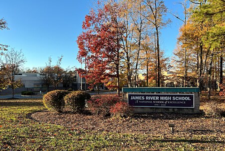
James River High School (Chesterfield County, Virginia)

Public high schools in VirginiaSchools in Chesterfield County, Virginia
James River High School

James River High School is located in northwestern Chesterfield County, Virginia, United States. James River is a part of Chesterfield County Public Schools.

Excerpt from the Wikipedia article James River High School (Chesterfield County, Virginia) (License: CC BY-SA 3.0, Authors, Images).

James River High School (Chesterfield County, Virginia)
Rivermist Road,

Geographical coordinates (GPS) Address External links Nearby Places
placeShow on map

Wikipedia: James River High School (Chesterfield County, Virginia)Continue reading on Wikipedia

Geographical coordinates (GPS)

Latitude Longitude
N 37.5525 ° E -77.649166666667 °
placeShow on map

Address

James River High School

Rivermist Road
23113
Virginia, United States
mapOpen on Google Maps

linkWikiData (Q6142160)
linkOpenStreetMap (3111650)

James River High School
Share experience

Nearby Places

Salisbury (Chesterfield County, Virginia)

Salisbury was a house and plantation in northwestern Chesterfield County, Virginia in the Southside area of Metro Richmond, Virginia. It was most likely built in the early 1760s by Abraham Salle (c.1732-c.1800), a descendant of Huguenot refugees fleeing persecution in France. Salle's grandfather, also named Abraham (1670–1719), was the immigrant ancestor for most of the Huguenot Salles living in Colonial Virginia. Abraham Salle (the younger) had "assembled the original 1,500 acre tract between 1760 to 1763" from various parcels of land primarily owned by his uncles William and Robert Wooldridge. The Wooldridge's had inherited the land from their father, John "Blacksmith" Wooldridge (c.1678-1757), himself the immigrant ancestor of all Wooldridges living in the American South.Abraham sold it to Thomas Mann Randolph in 1777. Randolph used the plantation house as a hunting lodge. His main plantation Tuckahoe was just north of Salisbury, across the James River. The famed American patriot and statesman, Patrick Henry, rented the house during two of his terms as governor of Virginia from 1784 to 1786 because the governor's residence in Richmond used at the time of his tenure was not large enough to accommodate Henry's family. Eventually Salisbury was sold to Dr. Philip Turpin, a graduate of the University of Edinburgh. Upon Turpin's death at Salisbury, the plantation passed to his daughter and son-in-law, Caroline and Dr. Edward Johnson. Their son was Confederate Major General Edward Johnson who participated in the Civil War. After the conflict, Edward Johnson returned to Salisbury (which he had inherited in 1843) to farm along with his brother, Philip Turpin Johnson. The two brothers died at Salisbury in 1873 and 1882, respectively. In 1882, Salisbury, along with the rest of the estate of Philip T. Johnson, passed to Dr. Joseph W. Johnson, a druggist in Richmond.Dr. Johnson likely leased the land to the Salisbury coal company but in November 1905, he offered it for sale. In December 1905, the Salisbury estate was sold to H. D. Eichelberger (who represented the Ginter estate, owner of all of the former Clover Hill mining lands) for $25,000 (~$634,409 in 2022). Later, in 1906, Salisbury and its 1,585-acre property were sold to George Arents and Thomas F. Jefress. The two men were tobacco executives and entrepreneurs. Furthermore, Arents was the nephew of the affluent Richmond businessman, Lewis Ginter; while Jeffress built the Meadowbrook mansion in 1918 in southern Chesterfield which was said to have been the largest house ever built in Chesterfield County. (Unfortunately, it burned down in 1967 and is now the site of Meadowbrook Country Club.) In 1923, the over 150-year-old house burned down. It was sold by Richmond attorney James Marshall Turner to the Salisbury Corporation in June 1956 for $110,000 (~$911,517 in 2022) and was noted as "the largest individually owned tract located close to any major city in the East." This company built the subdivision of Salisbury starting in 1958. In the current day, the clubhouse of the Salisbury Country Club (established 1963) is located near where the Salisbury Plantation main house once stood and its central section was built to resemble the original Salisbury.
Midlothian, Virginia

Midlothian ( mid-LOH-thee-ən) is an unincorporated area and Census-designated place in Chesterfield County, Virginia, U.S. Settled as a coal town, Midlothian village experienced suburbanization effects and is now part of the western suburbs of Richmond, Virginia south of the James River in the Greater Richmond Region. Because of its unincorporated status, Midlothian has no formal government, and the name is used to represent the original small Village of Midlothian and a vast expanse of Chesterfield County in the northwest portion of Southside Richmond served by the Midlothian post office. The Village of Midlothian was named for the early 18th-century coal mining enterprises of the Wooldridge family. Incorporated in 1836, their Mid-Lothian Mining and Manufacturing Company employed free and enslaved people to do the deadly work of digging underground. Midlothian is the site of the first commercially-mined coal in the Colony of Virginia and North America.By the early 18th century, several mines were being developed in Chesterfield County by French Huguenots and others. The mine owners began to export the commodity from the region in the 1730s. Midlothian-area coal from Harry Heth's Black Heath mines heated the U.S. White House for President Thomas Jefferson. The transportation needs of coal shipping stimulated construction of a paved toll road (Virginia's first), the Manchester Turnpike in 1807; and the Chesterfield Railroad, Virginia's first, in 1831; each traveled the 13 miles (21 km) from the mining community to the port of Manchester, just below the Fall Line of the James River. In 1850, the Richmond and Danville Railroad built Coalfield Station, a freight and later passenger depot, near the mines. In the 1920s, the old turnpike was straightened and became part of the new east-west U.S. Route 60. A few decades later, residential neighborhoods were developed in Southside Richmond near Midlothian, including the large Salisbury community and the Brandermill planned development sited on Swift Creek Reservoir. In the 21st century, Midlothian extends many miles beyond the original village area. State Route 288 connects the community with Interstate 64 and the State Route 76 "Powhite Parkway" toll road, and Interstate 95 in the Richmond metropolitan area's southwestern quadrant.

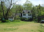
Aetna Hill (Midlothian, Virginia house)

Aetna Hill is a house in Midlothian, Virginia. It was built soon after 1791 by Thompson Blunt, who had just married Frances Morrisette, a granddaughter of Pierre Morrisette, one of the early Huguenot settlers. This original building consisted of "a 1 1/2 story Huguenot-style structure with a three-bay facade and twin front doors".In 1831 Thompson Blunt retired to Powhatan County and left Aetna Hill and its lands to his daughter Moriah and her husband, Elijah Brummall. A large addition was made to the house around 1840, when a 2+1⁄2-story, side passage house adjoining the west side of the original house was completed. In 1928, the house was in the possession of a local preacher named Robert H. Winfree. How the house came into the possession of Rev. Winfree is unclear, but it might have been inherited by his wife, Maria P. Watlington Winfree. Maria was the daughter of John O. W. Watlington and Ann Maria Brummall, who was the daughter of Elijah and Moriah.Winfree was the pastor of nearby Jerusalem Baptist Church (later renamed Winfree Memorial Baptist Church, in honor of him and his father David B. Winfree, Jerusalem's first pastor), where he preached at for more than 30 years. The Midlothian and Chesterfield County historian, Bettie Woodson Weaver, also lived here with her mother, who was Robert H. Winfree's daughter, in her early years.After going to college and marrying Albert Weaver, Bettie returned to Aetna Hill after World War II and started renovated the building over the next three years, adding heating, electricity, and indoor plumbing to the 150-year-old house. The facade of the original 1791 house was altered when one of the front doors was taken off and replaced with a wide double window. Weaver lived at the house until very shortly before her death, writing and publishing 11 books and countless articles.In the present day, Aetna Hill is largely untouched and the main house appears as it did in the 1840s, with slight alterations. Its lands are one of the largest sections of still standing forests in central Midlothian.