place

Røyken Station

1872 establishments in NorwayNorwegian railway station stubsRailway stations in Norway opened in the 1870sRailway stations in RøykenRailway stations on the Spikkestad Line
Railway stations opened in 1872
Røyken stasjon TRS 070106 017

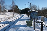
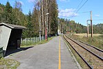
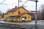
Røyken is a railway station on the Spikkestad Line and is located in Røyken, Norway. The station was opened as part of Drammenbanen in 1872 and was for many years the only railway station in Røyken. The station was located close the old Church in Røyken (from 1229). The station is served by commuter trains to Oslo Central Station and onward to Lillestrøm. The distance to Oslo S is 33 kilometers (21 mi) and the travel time is 45 minutes.

Excerpt from the Wikipedia article Røyken Station (License: CC BY-SA 3.0, Authors, Images).

Røyken Station
Klokkergård terrasse, Asker

Geographical coordinates (GPS) Address Nearby Places
placeShow on map

Wikipedia: Røyken StationContinue reading on Wikipedia

Geographical coordinates (GPS)

Latitude Longitude
N 59.746666666667 ° E 10.389722222222 °
placeShow on map

Address

Røyken

Klokkergård terrasse
3440 Asker
Norway
mapOpen on Google Maps

Røyken stasjon TRS 070106 017
Share experience

Nearby Places

Spikkestad
Spikkestad

Spikkestad is a village in the municipality of Asker, in the province of Akershus, Norway. Its current population (2022) is between 4000 and 5000.Spikkestad is located in the northern part of the peninsula of Hurumlandet, closer to the Drammensfjord than the Oslo Fjord. Spikkestad railway station was opened in 1885 to link Asker to Drammen. The village was named after the farm "Spikkestad", as the station was built on its lands. In the early 1970s, the Lieråsen tunnel was built 3 km to the North-West of the village, which made the trip between Oslo and Drammen much shorter. The segment of the train track between Spikkestad and Drammen was closed after the tunnel opened. Spikkestad thus became the terminus of Spikkestadbanen. However, there are still trains running between Asker and Spikkestad, every half-hour. Spikkestad is also well connected by road. The Norwegian National Road 23 (now European highway E134) runs through the outskirts of the village and the road provides links to Drammen and Drøbak. Drammen is the closest large city, only 11 km away from Spikkestad. During the industrialization of the town at the end of the 19th century, factories and schools, as well as an influx of new inhabitants made the village into more than just a train station. The manufacturing company Elopak was founded in Spikkestad in 1957.Spikkestad and the area surrounding it have a long history dating back to the viking era. Once a year, the community organizes an historic walk (Oldtidsveien), which travels along sites such as a historic burial site. It runs from Gullaug on the Drammen Fjord to Slemmestad on the Oslo Fjord.

Drammensfjord
Drammensfjord

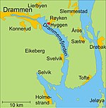
Drammensfjord (English: Drammen Fjord) is a fjord in Norway that connects to Ytre Oslofjord on the west side. It stretches to the north and northeast. The Drammenselva river discharges into the head of the fjord. The municipality and city of Drammen which is named after the fjord is also found there. The majority of the fjord is within the county of Buskerud, but in the west and southwest it lies in Vestfold county. The land on the east side of the fjord is called Hurumhalvøya or the Hurum peninsula; it separates the Drammensfjord from the Oslofjord. The fjord narrows to a strait at Svelvik in Vestfold on the west side and Verket in Hurum on the east side. The strait is crossed by an automobile ferry. This narrowing, some 200 meters broad and 10 meters deep, combined with the large freshwater inflow from the Drammenselva (one of Norway's largest rivers) and from Lierelva (river), results in the water north of the strait being brackish water. On the surface the water is fairly fresh, resulting in bathing areas that are free of jelly fish, while deeper the water has a higher salt concentration, with saltwater fish such as cod, pollock, flounder, and mackerel. The tide sets up one of Norway's strongest currents through the strait (outflow can reach speeds of 5 knots and the strait is known Selvikstrømmen (the Svelvik current) in Norwegian. Large ships can only sail in daylight and the largest only when assisted by tugboats. The strait has been made wider and deeper to accommodate traffic. Dead coral reefs are also found at 10–20 meters deep in the fjord. The maximum depth of the fjord northwards of the strait is 117 meters. For a number of decades the Drammensfjord was polluted. The sewage and industrial discharges by industries in Drammen have been corrected so that the water is now much cleaner. Salmon and sea trout are again found in both the fjord and the Drammenselva. In old Norse times the Drammensfjord was known by the name Dramn or Drofn, meaning hazy waters. In the Norse sagas Snorre Sturlason tells that Saint Olav hid himself from Canute the Great at a fjord which was called Dramn. At that time the water stood 4-5 meters higher and the fjord reached up to Hokksund. During the Viking Age, Drammensfjorden north of the Svelvik Strait was regarded as a lake and the Svelvik Strait was regarded as the mouth of the Drammen River.