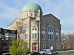
Mondawmin station

Mondawmin station is a Metro SubwayLink station in Baltimore, Maryland. It is located under the intersection of Reisterstown Road and Liberty Heights Avenue in the Mondawmin neighborhood, adjacent to the Mondawmin Mall. It is the northernmost underground station on the line, and a major transfer point to many bus routes. Mondawmin station serves Mondawmin Mall, Coppin State University, Druid Hill Park, The Maryland Zoo in Baltimore, and the Lower Park Heights neighborhood. The station's location next to Mondawmin Mall, Baltimore's oldest mall, has led its owners to plan an expansion.On the surface, a bus loop connects to Reisterstown Road and Liberty Heights Avenue. This loop and the adjacent streets are used by a number of bus routes, many of which terminate in it. Several routes were cut back to Mondawmin on June 18, 1984, about seven months after the station opened, and Routes M-1, M-2, and M-3 were formed at that time to replace the portions of those routes beyond Mondawmin. Specifically, Route M-1 was split from Route 28 (now Route 5 near Mondawmin), Route M-2 was split from Route 7, and Route M-3 was split from Route 5.
Excerpt from the Wikipedia article Mondawmin station (License: CC BY-SA 3.0, Authors, Images).Mondawmin station
Reisterstown Road, Baltimore Mondawmin
Geographical coordinates (GPS) Address Nearby Places Show on map
Geographical coordinates (GPS)
| Latitude | Longitude |
|---|---|
| N 39.31817 ° | E -76.652695 ° |
Address
Reisterstown Road
21217 Baltimore, Mondawmin
Maryland, United States
Open on Google Maps


