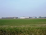
Harswell

Harswell is a village and former civil parish, now in the parish of Everingham, in the East Riding of Yorkshire, England. It is approximately 3.5 miles (5.6 km) west of Market Weighton town centre, 5 miles (8 km) south of Pocklington town centre, and 1 mile (1.6 km) west of the A614 road. In 1931 the parish had a population of 78. In 1823 Harswell was a village and civil parish in the Wapentake of Harthill. Population at the time was 78, with occupations that included five farmers, and a carrier who operated between the village and Market Weighton once a week. On 1 April 1935 the parish was abolished and merged with Everingham. The village church is dedicated to St Peter. There has been a church in Harswell from the late 12th century and the building that was present in 1823 was described by Baines as "a small ancient structure". It was rebuilt in 1870-1871 and parish records, dating back to 1653, are held by the Borthwick Institute in York. Harswell was served by Everingham railway station on the Selby to Driffield Line between 1853 and 1954. The station house is now a Grade II listed building.
Excerpt from the Wikipedia article Harswell (License: CC BY-SA 3.0, Authors, Images).Harswell
Harswell Lane,
Geographical coordinates (GPS) Address Nearby Places Show on map
Geographical coordinates (GPS)
| Latitude | Longitude |
|---|---|
| N 53.857764 ° | E -0.745652 ° |
Address
Harswell Lane
Harswell Lane
YO42 4LE , Everingham
England, United Kingdom
Open on Google Maps


