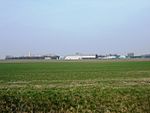
Holme-on-Spalding-Moor

Holme-on-Spalding-Moor (also known as Holme-upon-Spalding-Moor) is a large village and civil parish in the East Riding of Yorkshire, England. It is situated approximately 7 miles (11 km) north-east of Howden and 5 miles (8 km) south-west of Market Weighton. It lies on the A163 road where it joins the A614 road. In terms of major cities, the village is closest to York which is 15 miles (24 km) away, while Hull is 22 miles (35 km) away. The civil parish is formed by the village of Holme-on-Spalding-Moor and the hamlets of Bursea, Hasholme, Tollingham and Welhambridge. According to the 2011 UK Census, Holme-on-Spalding-Moor parish had a population of 3,172, an increase on the 2001 UK Census figure of 2,948.
Excerpt from the Wikipedia article Holme-on-Spalding-Moor (License: CC BY-SA 3.0, Authors, Images).Holme-on-Spalding-Moor
Selby Road,
Geographical coordinates (GPS) Address Nearby Places Show on map
Geographical coordinates (GPS)
| Latitude | Longitude |
|---|---|
| N 53.83653 ° | E -0.7782 ° |
Address
Selby Road
Selby Road
YO43 4EY , Holme upon Spalding Moor
England, United Kingdom
Open on Google Maps


