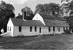
Mattatuxet River
North Kingstown, Rhode IslandNortheastern United States river stubsRhode Island geography stubsRivers of Rhode IslandRivers of Washington County, Rhode Island
The Mattatuxet River is a river in the U.S. state of Rhode Island. It flows approximately 3 km (2 mi). There are two dams along the river's length.
Excerpt from the Wikipedia article Mattatuxet River (License: CC BY-SA 3.0, Authors).Mattatuxet River
Shady Lea Road,
Geographical coordinates (GPS) Address Phone number Website Nearby Places Show on map
Geographical coordinates (GPS)
| Latitude | Longitude |
|---|---|
| N 41.5327 ° | E -71.462248 ° |
Address
The Mill at Shady Lea
Shady Lea Road 215
02852
Rhode Island, United States
Open on Google Maps


