place

Pettaquamscutt River

Narragansett, Rhode IslandNorth Kingstown, Rhode IslandNortheastern United States river stubsRhode Island geography stubsRivers of Rhode Island
Rivers of Washington County, Rhode IslandSouth Kingstown, Rhode Island

The Pettaquamscutt River (also known as Narrow River) is a tidal extension of the Mattatuxet River in the U.S. state of Rhode Island. It flows approximately 6.3 miles (10.1 km). There are no dams along the river's length.

Excerpt from the Wikipedia article Pettaquamscutt River (License: CC BY-SA 3.0, Authors).

Pettaquamscutt River
Gilbert Stuart Road,

Geographical coordinates (GPS) Address Nearby Places
placeShow on map

Wikipedia: Pettaquamscutt RiverContinue reading on Wikipedia

Geographical coordinates (GPS)

Latitude Longitude
N 41.519083 ° E -71.445492 °
placeShow on map

Address

Gilbert Stuart Road 904
02874
Rhode Island, United States
mapOpen on Google Maps

Share experience

Nearby Places

Hannah Robinson Tower

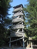
The Hannah Robinson Tower is a 40 feet (12 m) tall wooden tower at the interchange between U.S. Route 1 (Tower Hill Road) and Route 138 (Bridgetown Road) in the community of South Kingstown, South County, Rhode Island. The tower was built in 1938 by the Civilian Conservation Corps and was rebuilt in 1988 using the same pillars. The structure is named after Hannah Robinson (1746–1773), a colonial Rhode Island resident and daughter of a wealthy Narragansett society man, Rowland Robinson. Hannah fell in love with a local teacher, Peter Simon, but the relationship was deemed unsuitable by her father. Despite her father's disapproval, Hannah Robinson married her suitor and lived in Providence, Rhode Island. The family became estranged from Robinson, who was enveloped in poverty, leading to a fatal decline. Robinson's father ended his opposition and left his community of Boston Neck to bring Hannah home. As Rowland Robinson brought his daughter home, she requested a chance to visit nearby McSparran Hill, where she considered a view of her homeland. Robinson died soon after. In 1966, the owner of the land along McSparran Hill, sold off the 1.52-acre (0.62 ha) of land along with the rock to Preserve Rhode Island. Although owned by Preserve Rhode Island, the property is managed independently by Rhode Island Department of Environmental Management. The state maintains the area as public open space as a memorial to Hannah Robinson.