place

Solløkka

SandefjordVestfold geography stubsVillages in Vestfold og Telemark
Sollökka 1
Sollökka 1

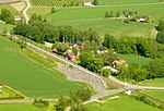
Solløkka is a village in Sandefjord Municipality in Vestfold county, Norway. The village is located at the north end of the Lahellefjorden, just across the fjord from the village of Lahelle. The village sits about 1 kilometre (0.62 mi) to the southeast of the village of Helgerød and about 5 kilometres (3.1 mi) east of the city of Sandefjord. Solløkka is considered to be one of the outer neighborhoods in the eastern part of the city of Sandefjord which has an area of 24 square kilometres (9.3 sq mi) and a population (in 2022) of 45,816. The statistical area Solløkka, which also can include the peripheral parts of the village as well as the surrounding countryside, has a population of 331.Solløkka has a boat harbor and a 70-metre (230 ft) long sandy beach area plus it also has a number of cabins and vacation homes and a campground (“Solløkka camping og leirsted”).

Excerpt from the Wikipedia article Solløkka (License: CC BY-SA 3.0, Authors, Images).

Solløkka
Solløkkaveien, Sandefjord

Geographical coordinates (GPS) Address Nearby Places
placeShow on map

Wikipedia: SolløkkaContinue reading on Wikipedia

Geographical coordinates (GPS)

Latitude Longitude
N 59.13977 ° E 10.29683 °
placeShow on map

Address

Solløkkaveien 40
3233 Sandefjord
Norway
mapOpen on Google Maps

Sollökka 1
Sollökka 1
Share experience

Nearby Places

Natholmen
Natholmen

Natholmen or Nattholmen is an island in Sandefjord Municipality in Vestfold county, Norway. The island is located in the Tønsbergfjorden at the entrance to the Lahellefjorden. The 0.22-square-kilometre (22 ha; 54-acre) island is situated about 5 kilometres (3.1 mi) to the east of the town of Sandefjord. The island was only accessible by boat until a bridge was installed in 1920 connecting the island to the mainland. The inhabited island is the home to Knattholmen Campground (Knattholmen leirsted), which is the oldest campground in Norway.On 12 August 1923 the YWCA-YMCA (Norwegian: KFUK-KFUM) established the campground on the island. The campground is called Knattholmen, which may have been the original name given to the island.: 219 The island was the largest island in the municipality of Sandefjord prior to the 2017 merger with Andebu and Stokke. It is 900 metres (3,000 ft) long from north to south, and 400 metres (1,300 ft) wide at its widest from east to west. It is located between the Lahellefjord and the Tønsbergfjord. It is 6 kilometres (3.7 mi) east of the centre of the city of Sandefjord, and immediately south of the Årø peninsula. The island is a gated community that is connected to the mainland by a private bridge. However, there is a parking lot by the gate, which can be accessed by pedestrians. There is also a public bus route to the island (route 163). Attractions on the island include Sandbukta ("sand bay"), which is a beach on its eastern side. It is also a common destination for recreational activities such as camping, paddling, sea trout fishing, hiking, and sailing. It has surrounding views of the Tønsbergfjord and the nearby Stauper islands. A former customs station on the island, known as Blåsen, has also become a landmark. The island hosts annual summer camps for the Queer Youth Festival and the YWCA-YMCA Guides and Scouts of Norway.