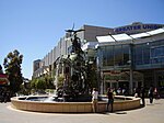
Hornsby Shire
1906 establishments in AustraliaHornsby ShireLocal government areas in SydneyUse Australian English from July 2011

Hornsby Shire is a local government area situated in Northern Sydney (Upper North Shore), as well as parts of the Hills District, in the state of New South Wales, Australia. The shire stretches from the M2 Hills Motorway in the south to the Hawkesbury River town of Wisemans Ferry, some 53 kilometres (33 mi) to the north, making it the largest local government council in the Greater Sydney Metropolitan region by total area. As of the 2016 census the shire had an estimated population of 142,667.The mayor of Hornsby Shire is Cr Philip Ruddock, a member of the Liberal Party, who was elected on 9 September 2017.
Excerpt from the Wikipedia article Hornsby Shire (License: CC BY-SA 3.0, Authors, Images).Hornsby Shire
George Street, Sydney
Geographical coordinates (GPS) Address Nearby Places Show on map
Geographical coordinates (GPS)
| Latitude | Longitude |
|---|---|
| N -33.7 ° | E 151.1 ° |
Address
George Street 116-122
2077 Sydney
New South Wales, Australia
Open on Google Maps


