Thurrock

Thurrock () is a unitary authority area with borough status in the ceremonial county of Essex, England. It lies on the north bank of the River Thames immediately east of London and has over 18 miles (29 km) of riverfront including the Port of Tilbury, the principal port for London. Thurrock is within the London commuter belt and is an area of regeneration within the Thames Gateway redevelopment zone. The borough includes the northern ends of the Dartford Crossing. The local authority is Thurrock Council, based in Grays. The borough also includes Purfleet-on-Thames, South Ockendon, Stanford-le-Hope and Tilbury, as well as other villages and surrounding areas. More than half of the borough is designated as Green Belt. The neighbouring districts are the London Borough of Havering, Brentwood, Basildon and Castle Point. On the opposite side of the Thames are Gravesham and Dartford in Kent.
Excerpt from the Wikipedia article Thurrock (License: CC BY-SA 3.0, Authors, Images).Thurrock
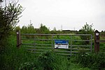
Walton's Hall Road, Thurrock
Geographical coordinates (GPS) Address Nearby Places Show on map
Geographical coordinates (GPS)
| Latitude | Longitude |
|---|---|
| N 51.5 ° | E 0.41666666666667 ° |
Address
Walton's Hall Road
Walton's Hall Road
SS17 0RH Thurrock, The Bonners
England, United Kingdom
Open on Google Maps


