Paya Lebar
East Region, SingaporePaya LebarPlaces in SingaporeSingapore geography stubs

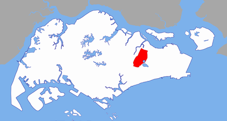
Paya Lebar is a planning area located in the East Region of Singapore, bordered by Hougang to the west, Sengkang to the northwest, Tampines to the east, Bedok to the south and Pasir Ris to the north. As part of the Singapore Urban Redevelopment Authority's (URA) Master Plan 2014, Paya Lebar Central was identified as one of the five growth areas. It was since earmarked as an up-and-coming commercial hub, in line with the wider decentralisation strategy to ensure the city's sustainable growth. Paya Lebar participates in the pilot Business Improvement District (BID) programme.
Excerpt from the Wikipedia article Paya Lebar (License: CC BY-SA 3.0, Authors, Images).Paya Lebar
Defu Avenue 1,
Geographical coordinates (GPS) Address Nearby Places Show on map
Geographical coordinates (GPS)
| Latitude | Longitude |
|---|---|
| N 1.3533 ° | E 103.8937 ° |
Address
Defu Avenue 1
Defu Avenue 1
539202 , Hougang
Singapore
Open on Google Maps


