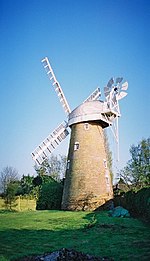
Ramsden Heath
City of ChelmsfordEssex geography stubsVillages in Essex

Ramsden Heath is a village in Essex in the east of England. It is located approximately 8 mi (13 km) south of the county town of Chelmsford; the closest towns are Billericay, approximately 3 mi (4.8 km) west-southwest, and Wickford, approximately 3.5 mi (5.6 km) southeast. The village is close to Hanningfield Reservoir. The smaller village of Downham is immediately to the east. In 2018 Ramsden Heath had an estimated population of 1,966. The parish council is South Hanningfield, the local authority is the City of Chelmsford and it is within the parliamentary constituency of Maldon. Ramsden Heath has approximately 600 households.
Excerpt from the Wikipedia article Ramsden Heath (License: CC BY-SA 3.0, Authors, Images).Ramsden Heath
Recreation Walk, Chelmsford South Hanningfield
Geographical coordinates (GPS) Address Nearby Places Show on map
Geographical coordinates (GPS)
| Latitude | Longitude |
|---|---|
| N 51.637 ° | E 0.4718 ° |
Address
Recreation Walk
Recreation Walk
CM11 1HZ Chelmsford, South Hanningfield
England, United Kingdom
Open on Google Maps


