place

Dale Farm

Borough of BasildonIrish Traveller-related controversiesIrish Travellers in the United KingdomUse British English from April 2012
Dale Farm scaffolding and sign

Dale Farm is a plot of land situated on Oak Lane in Crays Hill, Essex, United Kingdom. Until October 2011, it was the site of one of the largest Traveller concentrations in the UK, at its height housing over 1,000 people, along with the adjacent Oak Land site. Although Basildon District Council had granted permission for the site to be used by a small number of Traveller families, no planning permission was given for the expansion of the site into land located within the Green Belt.The establishment of the illegal plots led to Basildon District Council conducting a ten-year legal battle in the High Court to gain a clearance order to evict the Travellers from Dale Farm. The decision to bring in police officers to remove some activists and residents from the site and give safe access to the contracted bailiffs gained international press coverage, with the overall eviction costing the council £4.8 million.

Excerpt from the Wikipedia article Dale Farm (License: CC BY-SA 3.0, Authors, Images).

Dale Farm
Oak Lane, Essex

Geographical coordinates (GPS) Address Nearby Places
placeShow on map

Wikipedia: Dale FarmContinue reading on Wikipedia

Geographical coordinates (GPS)

Latitude Longitude
N 51.595 ° E 0.474 °
placeShow on map

Address

Oak Lane

Oak Lane
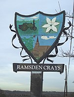
CM11 2YH Essex, Ramsden Crays
England, United Kingdom
mapOpen on Google Maps

Dale Farm scaffolding and sign
Share experience

Nearby Places

Basildon
Basildon

Basildon ( BAZ-il-dən) is the largest town in the borough of Basildon, within the county of Essex, England. It had a recorded population of 107,123. In 1931, the town had a population of 1,159.It lies 26 miles (42 km) east of Central London, 11 miles (18 km) south of the city of Chelmsford and 10 miles (16 km) west of the city of Southend-on-Sea. Nearby towns include Billericay to the north-west, Wickford to the north-east and South Benfleet to the south-east. It was created as a new town after World War II in 1948, to accommodate the London population overspill from the conglomeration of four small villages, namely Pitsea, Laindon, Basildon (the most central of the four) and Vange. The local government district of Basildon, which was formed in 1974 and received borough status in 2010, encapsulates a larger area than the town itself; the two neighbouring towns of Billericay and Wickford, as well as rural villages and smaller settlements set among the surrounding countryside, fall within its borders. Basildon Town is one of the most densely populated areas in the county. The parish of Basildon was abolished to create Billericay on 1 January 1937.Some of Basildon's residents work in Central London, due to the town being well connected in the county to the City of London and the Docklands financial and corporate headquarters districts, with a 36–58 minute journey from the three Basildon stations on the C2c to London Fenchurch Street. Basildon also has access to the City via road, on the A127 and A13.