place

RAF West Drayton

1924 establishments in the United KingdomFormer buildings and structures in the London Borough of HillingdonMilitary history of MiddlesexRoyal Air Force stations in LondonTransport in the London Borough of Hillingdon
Use British English from May 2013

RAF West Drayton was a non-flying Royal Air Force station in West Drayton, within the London Borough of Hillingdon, which served as the main centre for military air traffic control in the United Kingdom. It was co-located with the civilian London Air Traffic Control Centre to provide a vital link between civil and military flying and airspace requirements. Following the departure of the remaining civil and military air traffic control systems by 2008, the site was closed and demolished for a new residential development.

Excerpt from the Wikipedia article RAF West Drayton (License: CC BY-SA 3.0, Authors).

RAF West Drayton
Winter Green Drive, London West Drayton (London Borough of Hillingdon)

Geographical coordinates (GPS) Address Nearby Places
placeShow on map

Wikipedia: RAF West DraytonContinue reading on Wikipedia

Geographical coordinates (GPS)

Latitude Longitude
N 51.5049 ° E -0.4615 °
placeShow on map

Address

Winter Green Drive 1
UB7 9FQ London, West Drayton (London Borough of Hillingdon, Drayton Garden Village)
England, United Kingdom
mapOpen on Google Maps

Share experience

Nearby Places

Otter Dock
Otter Dock

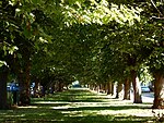
Otter Dock was a branch of the Grand Junction Canal (renamed Grand Union Canal from 1929) in Yiewsley, Middlesex. In March 1818, permission was obtained from the Grand Junction Canal Company by a Mr John Mills for a dock to be built to service Yiewsley's brickmaking industry. Otter Dock would be the longest of nine arms and docks that served Yiewsley's industries. It was opened in 1820 and after several expansions extended 1,200 yards (0.7 of a mile /1.1 km) north from the mainline of the canal. With the inclusion of the arms within Otter dock, its total length was 1845 yards (1.05 miles /1.68 km).Through the rest of the nineteenth century brick-earth was moulded and fired in clamp kilns within Yiewsley's brick-fields with the finished bricks being transported via the Otter Dock and the Grand Junction Canal Paddington Arm to the South Wharf in the Paddington Basin and also to wharves situated along the Regent's Canal and to other locations along the canal and the River Thames. The bricks were then used in the construction of 19th-century London. By the beginning of the 20th century, the brick-fields and the later gravel pits which the Otter Dock served had been worked out. By November 1906 a cofferdam had been placed at its entrance from the Grand Junction Canal mainline. Filling in Otter Dock north of Horton Road began in 1909 and was completed in 1911. On 17 November 1910 work began on planting 70 chestnut and beech trees along the filled-in canal between Colham Road (known as Wharf or Dock Road until May 1904.) and Ernest Road in the southern section of the former Arm. The roads were renamed Colham Avenue in 1938. The wide boulevard of Poplar Avenue was part of the northern section of the Arm. South of Horton road Otter Dock remained through much of the 20th Century and was used in the 1930s as a boat repair facility. A water pumping station of the Rickmansworth & Uxbridge Valley Water Works Co was constructed adjacent to the truncated arm. The dock was also used by the Johnson's wax company and by timber merchant James Davies Ltd.In the late twentieth century the arm was filled in and today the site of the dock and pumping station is the location of the Knowles Close housing estate.