place

St Catherine's Church, West Drayton

1867 establishments in England19th-century Roman Catholic church buildings in the United KingdomChurches in the Roman Catholic Diocese of WestminsterCommons link is the pagenameGothic Revival church buildings in London
Grade II listed buildings in the London Borough of HillingdonGrade II listed churches in LondonReligious organizations established in 1867Roman Catholic churches completed in 1869Roman Catholic churches in the London Borough of Hillingdon
Roman Catholic Church of St Catherine, West Drayton (01)

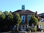
St Catherine's Church or St Catherine of Alexandria Church is a Catholic parish church in West Drayton, Borough of Hillingdon, London. It was built from 1868 to 1869 and designed by Thomas John Willson and Samuel Joseph Nicholl. It is architecturally in the Gothic Revival style and was paid for by the Irish immigrants living in the west Drayton area. It is situated on The Green near the town centre. On 12 May 2016, it was designated a Grade II listed building.

Excerpt from the Wikipedia article St Catherine's Church, West Drayton (License: CC BY-SA 3.0, Authors, Images).

St Catherine's Church, West Drayton
The Green, London Yiewsley (London Borough of Hillingdon)

Geographical coordinates (GPS) Address External links Nearby Places
placeShow on map

Wikipedia: St Catherine's Church, West DraytonContinue reading on Wikipedia

Geographical coordinates (GPS)

Latitude Longitude
N 51.5043 ° E -0.4763 °
placeShow on map

Address

St Catherine

The Green
UB7 7PH London, Yiewsley (London Borough of Hillingdon)
England, United Kingdom
mapOpen on Google Maps

linkWikiData ()
linkOpenStreetMap (921987310)

Roman Catholic Church of St Catherine, West Drayton (01)
Share experience

Nearby Places

Otter Dock
Otter Dock

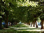
Otter Dock was a branch of the Grand Junction Canal (renamed Grand Union Canal from 1929) in Yiewsley, Middlesex. In March 1818, permission was obtained from the Grand Junction Canal Company by a Mr John Mills for a dock to be built to service Yiewsley's brickmaking industry. Otter Dock would be the longest of nine arms and docks that served Yiewsley's industries. It was opened in 1820 and after several expansions extended 1,200 yards (0.7 of a mile /1.1 km) north from the mainline of the canal. With the inclusion of the arms within Otter dock, its total length was 1845 yards (1.05 miles /1.68 km).Through the rest of the nineteenth century brick-earth was moulded and fired in clamp kilns within Yiewsley's brick-fields with the finished bricks being transported via the Otter Dock and the Grand Junction Canal Paddington Arm to the South Wharf in the Paddington Basin and also to wharves situated along the Regent's Canal and to other locations along the canal and the River Thames. The bricks were then used in the construction of 19th-century London. By the beginning of the 20th century, the brick-fields and the later gravel pits which the Otter Dock served had been worked out. By November 1906 a cofferdam had been placed at its entrance from the Grand Junction Canal mainline. Filling in Otter Dock north of Horton Road began in 1909 and was completed in 1911. On 17 November 1910 work began on planting 70 chestnut and beech trees along the filled-in canal between Colham Road (known as Wharf or Dock Road until May 1904.) and Ernest Road in the southern section of the former Arm. The roads were renamed Colham Avenue in 1938. The wide boulevard of Poplar Avenue was part of the northern section of the Arm. South of Horton road Otter Dock remained through much of the 20th Century and was used in the 1930s as a boat repair facility. A water pumping station of the Rickmansworth & Uxbridge Valley Water Works Co was constructed adjacent to the truncated arm. The dock was also used by the Johnson's wax company and by timber merchant James Davies Ltd.In the late twentieth century the arm was filled in and today the site of the dock and pumping station is the location of the Knowles Close housing estate.

Harmondsworth
Harmondsworth

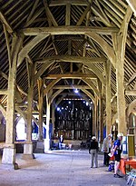
Harmondsworth is a village in the London Borough of Hillingdon in the county of Greater London with a short border to the south onto London Heathrow Airport and close to the Berkshire county border. The village has no railway stations, but adjoins the M4 motorway and the A4 road (the Bath Road). Harmondsworth was in the historic county of Middlesex until 1965. It is an ancient parish that once included the large hamlets of Heathrow, Longford and Sipson. Longford and Sipson have modern signposts and facilities as separate villages, remaining to a degree interdependent such as for schooling. The Great Barn and parish church are medieval buildings in the village. The largest proportion of land in commercial use is related to air transport and hospitality. The village includes public parkland with footpaths and abuts the River Colne and biodiverse land in its Regional Park to the west, once the grazing meadows and woodlands used for hogs of Colnbrook. The west of the parish has two major airline headquarters (international and local) and two immigration detention centres: the larger is for a maximum of 620 men without leave (permission) to enter or remain in the United Kingdom. Many international visitors stay within the church-based bounds of Harmondsworth, as all hotels are branded as "Heathrow", a former hamlet and other farmsteads that were absorbed by the airport. In October 2016 it was announced by HM Government that Heathrow Airport would receive permission to apply for a third runway. According to current expansion plans, around half of the existing village of Harmondsworth will have to be demolished to make way for the north-west runway and surrounding grass safety area. The other half, including the parish church and Great Barn, will be only a few metres from the airport perimeter.