Arrondissement of Tournai
Former arrondissements of BelgiumHainaut geography stubs

The Arrondissement of Tournai (French: Arrondissement de Tournai; Dutch: Arrondissement Doornik) is a former arrondissement in the Walloon province of Hainaut, Belgium. It is both an administrative and a judicial arrondissement. However, the Judicial Arrondissement of Tournai also comprises the municipality of Lessines in the Arrondissement of Soignies and all municipalities of the Arrondissement of Ath, with the exception of the municipalities of Brugelette and Chièvres. In 2019 it was merged into the new Arrondissement of Tournai-Mouscron.
Excerpt from the Wikipedia article Arrondissement of Tournai (License: CC BY-SA 3.0, Authors, Images).Arrondissement of Tournai
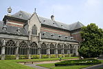
Boulevard du Roi Albert, Tournai
Geographical coordinates (GPS) Address Nearby Places Show on map
Geographical coordinates (GPS)
| Latitude | Longitude |
|---|---|
| N 50.6 ° | E 3.4 ° |
Address
Boulevard du Roi Albert
Boulevard du Roi Albert
7500 Tournai (Tournai)
Hainaut, Belgium
Open on Google Maps


