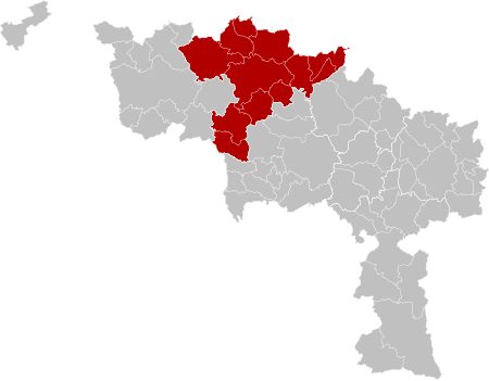
Arrondissement of Ath
Arrondissements of Hainaut (province)Hainaut geography stubs

The Arrondissement of Ath (French: Arrondissement d'Ath; Dutch: Arrondissement Aat) is one of the seven administrative arrondissements in the Walloon province of Hainaut, Belgium. It is not a judicial arrondissement. Two of its municipalities, Brugelette and Chièvres, are part of the Judicial Arrondissement of Mons, while the others are part of the Judicial Arrondissement of Tournai.
Excerpt from the Wikipedia article Arrondissement of Ath (License: CC BY-SA 3.0, Authors, Images).Arrondissement of Ath
Rue de Bétissart,
Geographical coordinates (GPS) Address Nearby Places Show on map
Geographical coordinates (GPS)
| Latitude | Longitude |
|---|---|
| N 50.6 ° | E 3.75 ° |
Address
Ormeignies Postes
Rue de Bétissart
7802 (Ormeignies)
Hainaut, Belgium
Open on Google Maps


