place

Waiʻanae Range

Cenozoic HawaiiExtinct volcanoes of the United StatesHawaiian–Emperor seamount chainLandforms of OahuMountains of Hawaii
Neogene OceaniaPleistocene shield volcanoesPliocene shield volcanoesPolygenetic shield volcanoesVolcanoes of OahuWaianae Range
Oahu Kukaniloko shape of Waianaes

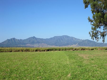
Waiʻanae Range (sometimes referred to as the Waianae Mountains) is the eroded remains of an ancient shield volcano that comprises the western half of the Hawaiian Island of Oʻahu. Its crest, at Kaʻala, is the highest peak on Oʻahu at 4,025 feet (1,227 m). Like the neighboring Koʻolau, the Waiʻanae Range is not a mountain range in the sense most people are familiar with, as the mountain range as a whole was created from a single volcano rather than plate tectonics. The oldest lava dated from the volcano are about 3.9 million years old. About 3.2 million years ago, the volcano's activity changed, the rate of eruption started to decrease and the composition of the lava erupted from the volcano changed. The volcano is thought to have last erupted about 2.5 million years ago. When active, the Waiʻanae volcano's center of activity was at present-day Lualualei Valley. Intense erosion on the western flank of the mountain has destroyed much of those flanks. Thus, the mountain today is much smaller than it was when the volcano was active. While the western part of the mountain has been destroyed by erosion, the eastern part is still in a youthful stage of erosion. This is considered somewhat strange by some geologists since the western part of the volcano is on the leeward side of the island; thus, most rain falls on the eastern side of the volcano. Given this information, more erosion would be expected on the eastern portion of the mountain. One theory to explain this erosion pattern is that a large landslide cut away the western portion of the volcano. The faults from this huge landslide weakened the rock, making the western part of the mountain much more susceptible to erosion than the eastern side.

Excerpt from the Wikipedia article Waiʻanae Range (License: CC BY-SA 3.0, Authors, Images).

Waiʻanae Range
Mount Kaala Road,

Geographical coordinates (GPS) Address Nearby Places
placeShow on map

Wikipedia: Waiʻanae RangeContinue reading on Wikipedia

Geographical coordinates (GPS)

Latitude Longitude
N 21.51 ° E -158.15 °
placeShow on map

Address

Mount Kaala Road

Mount Kaala Road
96791
Hawaii, United States
mapOpen on Google Maps

Oahu Kukaniloko shape of Waianaes
Share experience

Nearby Places

Mākaha, Hawaii
Mākaha, Hawaii

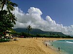
Mākaha (Hawaiian for "fierce", or "savage", pronounced [maːˈkɐhə]) is a census-designated place (CDP) in Honolulu County, Hawaiʻi, United States. It is a town located along the Pacific coast, west of the Mākaha Valley, and at the foot of Mt. Ka'ala in the Wai’anae Mountain Range. It is the last of the leeward towns on O'ahu. North of Mākaha there is no development, i.e. no towns, no gas stations, or restaurants. The population of Mākaha was 8,278 at the 2010 census. It is located 35 miles northwest of Honolulu, but is a part of Honolulu County. In the Hawaiian language its name means “fierce” or “savage”, which refers to the group of bandits who were based in the Mākaha Valley. They would hide and wait for unsuspecting passersby to show up, and then plunder and pillage them. Mākaha has a higher percentage of Native Hawaiians and other Pacific islanders than most settlements on O’ahu; 26.2% of the population were Pacific Islanders in 2010. Mākaha Resort stages weekend traditional Hawaiian arts and crafts fairs and other Hawaiian cultural programs in order to preserve the Native Hawaiian traditions in Mākaha.The town is particularly known for its surfing waves and surfing history, the Hawaiian temple Kāne’āki Heiau, and Mākaha Beach Park, which is a nesting place for several species of sea turtles. Aside from surfing, other water activities include diving, canoe-surfing, fishing, tandem surfing, bodysurfing, and other recreational water sports. Kāne’āki Heiau is Hawaii's most thoroughly restored ancient heiau, it was excavated by Bishop Museum archeologists in 1970 and can now be visited Tuesdays-Sundays. It originated as an agricultural temple to the god Lono in the 15th century. 200 years later, it was converted into a luakini, where human sacrifices were dedicated to the god Kū – a typical progression indicating Mākaha now supported a large enough population to have its own chief.