Mākaha, Hawaii

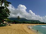
Mākaha (Hawaiian for "fierce", or "savage", pronounced [maːˈkɐhə]) is a census-designated place (CDP) in Honolulu County, Hawaiʻi, United States. It is a town located along the Pacific coast, west of the Mākaha Valley, and at the foot of Mt. Ka'ala in the Wai’anae Mountain Range. It is the last of the leeward towns on O'ahu. North of Mākaha there is no development, i.e. no towns, no gas stations, or restaurants. The population of Mākaha was 8,278 at the 2010 census. It is located 35 miles northwest of Honolulu, but is a part of Honolulu County. In the Hawaiian language its name means “fierce” or “savage”, which refers to the group of bandits who were based in the Mākaha Valley. They would hide and wait for unsuspecting passersby to show up, and then plunder and pillage them. Mākaha has a higher percentage of Native Hawaiians and other Pacific islanders than most settlements on O’ahu; 26.2% of the population were Pacific Islanders in 2010. Mākaha Resort stages weekend traditional Hawaiian arts and crafts fairs and other Hawaiian cultural programs in order to preserve the Native Hawaiian traditions in Mākaha.The town is particularly known for its surfing waves and surfing history, the Hawaiian temple Kāne’āki Heiau, and Mākaha Beach Park, which is a nesting place for several species of sea turtles. Aside from surfing, other water activities include diving, canoe-surfing, fishing, tandem surfing, bodysurfing, and other recreational water sports. Kāne’āki Heiau is Hawaii's most thoroughly restored ancient heiau, it was excavated by Bishop Museum archeologists in 1970 and can now be visited Tuesdays-Sundays. It originated as an agricultural temple to the god Lono in the 15th century. 200 years later, it was converted into a luakini, where human sacrifices were dedicated to the god Kū – a typical progression indicating Mākaha now supported a large enough population to have its own chief.
Excerpt from the Wikipedia article Mākaha, Hawaii (License: CC BY-SA 3.0, Authors, Images).Mākaha, Hawaii
Lahaina Street,
Geographical coordinates (GPS) Address Nearby Places Show on map
Geographical coordinates (GPS)
| Latitude | Longitude |
|---|---|
| N 21.470555555556 ° | E -158.21416666667 ° |
Address
Lahaina Street
Lahaina Street
96792
Hawaii, United States
Open on Google Maps


