Collins Street, Melbourne

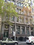
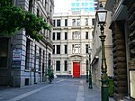
Collins Street is a major street in the centre of Melbourne, Victoria, Australia. It was laid out in the first survey of Melbourne, the original 1837 Hoddle Grid, and soon became the most desired address in the city. Collins Street was named after Lieutenant-Governor of Tasmania (then Van Diemen's Land) David Collins who led a group of settlers in establishing a short-lived settlement at Sorrento in 1803.The eastern end of Collins Street has been known colloquially as the 'Paris End' since the 1950s due to its numerous heritage buildings, old street trees, high-end shopping boutiques, and as the location for the first footpath cafes in the city. As with all main streets in the Melbourne city centre, the Hoddle Grid is exactly 99 feet wide which would allow for the installation of trams in 1885. Blocks further west centred around Queen Street became the financial heart of Melbourne in the 19th century, the preferred home of major banks and insurance companies, a tradition which continues today with the most prestigious office blocks and skyscrapers found along its length.
Excerpt from the Wikipedia article Collins Street, Melbourne (License: CC BY-SA 3.0, Authors, Images).Collins Street, Melbourne
Collins Street, Melbourne Melbourne
Geographical coordinates (GPS) Address Nearby Places Show on map
Geographical coordinates (GPS)
| Latitude | Longitude |
|---|---|
| N -37.8168 ° | E 144.9622 ° |
Address
Optus Centre
Collins Street 367
3000 Melbourne, Melbourne
Victoria, Australia
Open on Google Maps


