place

South Hadley High School

Public high schools in MassachusettsSchools in Hampshire County, MassachusettsSouth Hadley, Massachusetts
South Hadley High School, South Hadley MA

South Hadley High School is a secondary school in South Hadley, Massachusetts, United States, for students in grades 9–12. The school has a student population of just over 700. The school's name is frequently referred to as "SHHS".

Excerpt from the Wikipedia article South Hadley High School (License: CC BY-SA 3.0, Authors, Images).

South Hadley High School
Newton Street,

Geographical coordinates (GPS) Address Nearby Places
placeShow on map

Wikipedia: South Hadley High SchoolContinue reading on Wikipedia

Geographical coordinates (GPS)

Latitude Longitude
N 42.227663 ° E -72.586471 °
placeShow on map

Address

Newton Street 153
01075
Massachusetts, United States
mapOpen on Google Maps

South Hadley High School, South Hadley MA
Share experience

Nearby Places

The Flats, Holyoke, Massachusetts

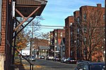
The Flats is a neighborhood in Holyoke, Massachusetts located to the east of the city center, adjacent to the downtown. Although it lies at one of the lowest elevations in Holyoke, its name derives not from topography but from the brick tenement "flats" which characterized its architecture throughout much of its history. Historically the area has also been associated with the name Depot Hill, as it was the location of the city's first freight and passenger railway stations; passenger service was restored at Holyoke station in 2015, following a period of absence after 1967. A section of the neighborhood between Lyman and Appleton Street to north and south respectively, and between Race and Bowers Street to the east and west is also known as Depot Square. Today the area features the Holyoke Innovation District, Canal System, Hadley Falls Company Housing District, Marcella Kelly Elementary School, local Amtrak station and 275 acres (111 ha) of residential, commercial, and industrial zoning. The Flats faced mass depopulation following the issuance of city master plans in 1961 and 1968, which called for its conversion from mixed zoning to entirely industrial land use; from 1970 to 1980 this urban renewal initiative, combined with fires from substandard housing conditions and arson, reduced the number of housing units in the neighborhood by 41%. In recent years municipal and state authorities have sought to redevelop the neighborhood as a startup company incubator and cultural center through the creation of the Innovation District and Canalwalk. Proposals have also been put forth for redevelopment of the historic H. H. Richardson train station as well as the Hotel Jess/Perkins Block. While not on the National Register of Historic Places, the latter holds historical significance as it was constructed by Benjamin F. Perkins, a contemporary of Alexander Graham Bell, who had manufactured and demonstrated early telephone equipment personally for the inventor during his visits to Holyoke, and whose eponymous block was the first headquarters of the Springfield Telephone and Automatic Signal Company, a division of the Bell company, and Western Massachusetts' first telephone exchange, established in 1878. That same year the building became one of two sites for the world's first public-use toll line, which connected Springfield and Holyoke when it entered service on June 15, 1878.

South Hadley Canal
South Hadley Canal

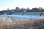
The South Hadley Canal was a canal along the Connecticut River in South Hadley, Massachusetts. It was the earliest navigable canal in the United States, with operation commencing in 1795. It has been listed on the National Register of Historic Places as the South Hadley Canal Historic District. The canal dates to February 1792, when leading citizens of western Massachusetts proposed to build a canal around the Great Falls at South Hadley, a 53-foot (16 m) drop in the Connecticut River that blocked boat transport. At that time, all cargo needed to be unloaded for 2.5 miles (4.0 km) of land transport around the falls, driving river transport cost for a bushel of wheat from Northampton, Massachusetts to Windsor, Connecticut to more than double its transport costs by sea from Hartford to Boston. John Hancock, then Governor of Massachusetts, signed the charter which incorporated the Proprietors of the Locks and Canals on the Connecticut River. Their corporate seal bore the motto "SIC TRANSIT - Public & Private Good". Funds were raised both locally and internationally, with four Dutch investment houses owning slightly over 50% of the stock. The canal was built by some 240 local workers. In April 1795 it opened to commercial traffic. (Nearby Turners Falls Canal opened three years later.) First year revenue came to $3,109 at 75 cents per ton. By 1816 tolls had grown to over $16,000. In 1826 the Barnet, the first steamboat to operate on the Connecticut River, passed through the South Hadley Canal on its way to Vermont. However, by 1843 competing railroads had begun to erode income, and the canal closed as uneconomical in 1862. Rather than use locks, the canal was built with an unusual "inclined plane" to transport 20-foot (6.1 m) by 60-foot (18 m) flatboats over the falls. The inclined plane appears to have been pioneered on England's Ketley Canal in 1788. This was its first use in American canals, and served as a pattern for others including the Morris Canal in New Jersey. On the South Hadley Canal's inclined plane, the boat was first maneuvered into a special cart, then hauled up or down a ramp built of solid stone, 275 feet (84 m) long by 30 feet (9.1 m) wide, covered with strong wood planks, and having a slope of 13.5 degrees. Lifting power was supplied by two overshot waterwheels 16 feet (4.9 m) in diameter, one on each side of the inclined plane, connected to the cart with chains. The cart had unequal wheel sizes to keep the boat level during transport. Total transport time was about 15 minutes. In 1805, after about 10 years of use, however, the inclined plane was replaced by a series of five locks when it was necessary to deepen the canal. Today The Bicentennial Canal Park serves as a historic memorial, preserving the historical remnants of the canal. The overlook deck provides vistas of the Mount Tom Range and the Connecticut River. Holyoke Gas & Electric maintains Texon Park, Lower Riverside Park, and Gatehouse Park along the Holyoke dam. Lower Riverside Park overlooks the site of the former inclined plane and lock system, remnants of which are still visible today.