place

Groene Hart

Regions of North HollandRegions of South HollandRegions of Utrecht (province)Regions of the NetherlandsUrban planning in the Netherlands
Locatie Groene Hart
Locatie Groene Hart

The Groene Hart (Dutch pronunciation: [ˈxrunə ˈɦɑrt]; English: Green Heart) is a relatively thinly populated area of the Netherlands covering much of the middle portion of the Randstad megalopolis. The major Dutch cities of Rotterdam, The Hague, Leiden, Haarlem, Amsterdam and Utrecht surround this area. Cities inside the Groene Hart include Zoetermeer, Alphen aan den Rijn, Gouda, Woerden and the smaller cities of Schoonhoven, Oudewater, Haastrecht, Nieuwkoop, Montfoort, Waddinxveen, Bodegraven and Boskoop. The Groene Hart is characterised by its rural character which contrasts the urban areas around it. Agriculture, nature and recreation are the primary activities in the Groene Hart. Residents and urban visitors can often find rest and many green spaces. Mills, dikes and Dutch cows are the primary landmarks of this lowland area. Thanks to the various separated cycle paths in the Groene Hart, the area can very well be explored by bike. The Groene Hart is of major importance to consolidate the number of Dutch meadow birds. The bird species black-tailed godwit, northern lapwing and Eurasian oystercatcher can all be found in the area.

Excerpt from the Wikipedia article Groene Hart (License: CC BY-SA 3.0, Authors, Images).

Groene Hart
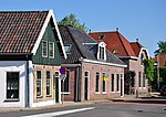
Steekterweg, Alphen aan den Rijn

Geographical coordinates (GPS) Address Nearby Places
placeShow on map

Wikipedia: Groene HartContinue reading on Wikipedia

Geographical coordinates (GPS)

Latitude Longitude
N 52.1125 ° E 4.7008333333333 °
placeShow on map

Address

Steekterweg

Steekterweg
2407 BH Alphen aan den Rijn
South Holland, Netherlands
mapOpen on Google Maps

Locatie Groene Hart
Locatie Groene Hart
Share experience

Nearby Places

Tempel, Berkel en Rodenrijs

Tempel, also known as De Tempel, is a former municipality and former manorial estate in the Dutch province of South Holland. It was located about 3 km southwest of the center of the current village of Berkel en Rodenrijs. According to the 19th-century historian A.J. van der Aa, Tempel was named after a manor house that used to be located in the area. around the beginning of the 19th century, the house was long gone. In nearby Overschie an estate can be found where in the 18th century the owner of Tempel used to live. He acquired it in 1715, after which the house Berkeloord was renamed to De Tempel. The manorial rights of Tempel were also applicable at the estate, even though it was located outside of its territory. After the introduction of the municipal system by the French in 1812, the area belonged to the municipality of Pijnacker, even though it was completely surrounded by the territory of Berkel en Rodenrijs. In 1817, the manorial rights were restored, and Tempel became a separate municipality, although it was very small (only 0.109 km2) and had no inhabitants. This was not a problem, as long as the lord of the area was prepared to pay for the municipal government. In 1855, the municipality became part of Berkel en Rodenrijs. Since 2007, Tempel is a part of Lansingerland, when Berkel en Rodenrijs merged with Bergschenhoek and Bleiswijk. The coat of arms of the manor and former municipality of Tempel depict a silver portal (i.e. a temple entrance), on a shield of gules. The flag is an armorial banner, with the portal placed off-center, towards the hoist.