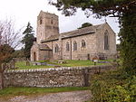
Tatham, Lancashire
Civil parishes in LancashireGeography of the City of LancasterLancashire geography stubsUse British English from April 2015Villages in Lancashire

Tatham is a village and civil parish in the City of Lancaster district in Lancashire, England. In 2001, it had a population of 393, increasing slightly to 396 at the 2011 Census.A large part of the parish of Tatham is an upland area, known as Tatham Fells, which includes the largest settlement in Tatham, Lowgill; its highest point, at Ward's Stone; and the Great Stone of Fourstones, known locally as "the Big Stone".
Excerpt from the Wikipedia article Tatham, Lancashire (License: CC BY-SA 3.0, Authors, Images).Tatham, Lancashire
Monks Gate, Lancaster
Geographical coordinates (GPS) Address Nearby Places Show on map
Geographical coordinates (GPS)
| Latitude | Longitude |
|---|---|
| N 54.119 ° | E -2.605 ° |
Address
Monks Gate
LA2 8NH Lancaster
England, United Kingdom
Open on Google Maps


