place

Aspetuck, Connecticut

Colonial Revival architecture in ConnecticutConnecticut placenames of Native American originEaston, ConnecticutHistoric districts in Fairfield County, ConnecticutNRHP infobox with nocat
Neighborhoods in ConnecticutUse mdy dates from July 2023Villages in Fairfield County, ConnecticutWeston, Connecticut

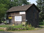
Aspetuck is a village, which in Connecticut is an unincorporated community on the Aspetuck River, in Fairfield County, Connecticut, mostly in the town of Easton but extending also into Weston. It is significant for being the location of the Aspectuck Historic District, a well-preserved collection of houses from the 18th and 19th centuries. The area was settled in the 17th century. It was a long-time home of Helen Keller. According to a New York Times real estate section article, "The district gets its name from the Aspetuck Indians, who lived along the river. In 1670, they sold the land to English settlers for cloth, winter wheat and maize valued at $.36." Weston was incorporated in 1787, and Easton was split out and incorporated in 1845.

Excerpt from the Wikipedia article Aspetuck, Connecticut (License: CC BY-SA 3.0, Authors).

Aspetuck, Connecticut
Redding Road,

Geographical coordinates (GPS) Address Nearby Places
placeShow on map

Wikipedia: Aspetuck, ConnecticutContinue reading on Wikipedia

Geographical coordinates (GPS)

Latitude Longitude
N 41.223333333333 ° E -73.323333333333 °
placeShow on map

Address

Redding Road

Redding Road
06490
United States
mapOpen on Google Maps

Share experience

Nearby Places

Fairfield County, Connecticut

Fairfield County is a county in the southwestern corner of the U.S. state of Connecticut. It is the most populous county in the state and was also its fastest-growing from 2010 to 2020. As of the 2020 census, the county's population was 957,419, representing 26.6% of Connecticut's overall population. The closest to the center of the New York metropolitan area, the county contains four of the state's top 7 largest cities—Bridgeport (1st), Stamford (2nd), Norwalk (6th), and Danbury (7th)—whose combined population of 433,368 is nearly half the county's total population. The United States Office of Management and Budget has designated Fairfield County as the Bridgeport–Stamford–Norwalk–Danbury metropolitan statistical area. The United States Census Bureau ranked the metropolitan area as the 59th most populous metropolitan statistical area of the United States in 2019. The U.S. Office of Management and Budget has further designated the metropolitan statistical area as a component of the more extensive New York–Newark–Bridgeport, NY–NJ–CT–PA combined statistical area, the most populous combined statistical area and primary statistical area of the United States.As is the case with all eight of Connecticut's counties, there is no county government and no county seat. As an area, it is only a geographical point of reference. In Connecticut, the cities and towns are responsible for all local governmental activities including fire and rescue, schools, and snow removal; in a few cases, neighboring towns will share certain resources. The last county seat was Bridgeport, which had served this role from 1853 until 1960. On June 6, 2022, the U.S. Census Bureau formally recognized Connecticut's nine councils of governments as county equivalents instead of the state's eight counties. Connecticut's eight historical counties continue to exist in name only, and are no longer considered for statistical purposes.Fairfield County's Gold Coast helped rank it sixth in the U.S. in per-capita personal income by the Bureau of Economic Analysis in 2005, contributing substantially to Connecticut being one of the most affluent states in the U.S. Other communities are more densely populated and economically diverse than the affluent areas for which the county is better known.