Fair Haven, New Haven

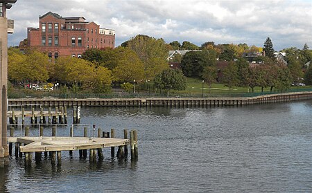
Fair Haven is a neighborhood in the eastern part of the city of New Haven, Connecticut, between the Mill and Quinnipiac rivers. The northeast section of the neighborhood is also known as Chatham Square. Fair Haven is located about two miles east of the New Haven Green comprising New Haven wards 14, 15, 16, and a portion of 8. It is bounded on the east and south by the Quinnipiac River, on the west by the Mill River, on the northwest by Amtrak railroad tracks, and on the north by I-91 (in the vicinity of Exit 7). The main through routes of the area are Grand Avenue, Blatchley Avenue, and Ferry Street. In its early days, the area was called by a succession of names including Farmes, East Farmes, The Neck, Dragon, and Clamtown. Herman Hotchkiss is credited as founder due to his investments and development. Fair Haven is not to be confused with the adjacent Fair Haven Heights neighborhood.
Excerpt from the Wikipedia article Fair Haven, New Haven (License: CC BY-SA 3.0, Authors, Images).Fair Haven, New Haven
Clay Street, New Haven
Geographical coordinates (GPS) Address Nearby Places Show on map
Geographical coordinates (GPS)
| Latitude | Longitude |
|---|---|
| N 41.311 ° | E -72.896 ° |
Address
Clay Street
06513 New Haven
Connecticut, United States
Open on Google Maps


