place

Lin-Wood Public School

Lincoln, New HampshirePublic elementary schools in New HampshirePublic high schools in New HampshirePublic middle schools in New HampshireSchools in Grafton County, New Hampshire
Use mdy dates from October 2011
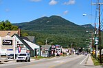
Lin Wood Public School July 2017

Lin-Wood Public School in Lincoln, New Hampshire is a public primary and secondary school located in the White Mountains of New Hampshire, serving the communities of Lincoln and Woodstock (hence the name Lin-Wood, from Lincoln and Woodstock). The school is operated by the Lincoln Woodstock Cooperative School District, the only "single school" SAU (School Administrative Unit) in the state. The school has students from kindergarten through 12th grade in its elementary, middle and high schools, which are located on one campus. Grades K-5 are housed in a building first opened for the 1991–92 school year, while grades 6–12 attend classes in a building originally built in 1963 to house the first cooperative Linwood High School (SAU 68).

Excerpt from the Wikipedia article Lin-Wood Public School (License: CC BY-SA 3.0, Authors, Images).

Lin-Wood Public School
Rue de Gionet,

Geographical coordinates (GPS) Address Nearby Places
placeShow on map

Wikipedia: Lin-Wood Public SchoolContinue reading on Wikipedia

Geographical coordinates (GPS)

Latitude Longitude
N 44.043055555556 ° E -71.673055555556 °
placeShow on map

Address

Lin-Wood Public School

Rue de Gionet
03251
New Hampshire, United States
mapOpen on Google Maps

Lin Wood Public School July 2017
Share experience

Nearby Places

Mount Pemigewasset
Mount Pemigewasset

Mount Pemigewasset, or Indian Head, is a mountain in Franconia Notch in the White Mountains in Grafton County, New Hampshire, United States. It lies near the town of Lincoln.The mountain is known for the distinctive cliff along the southern side of its summit, which resembles the profile of a Native American head. Such shapes are formed when water enters cracks in the granite. Over time, the water freezes and expands, which further shapes and cracks the rock. The "face" measures 98 feet (30 m) from chin to forehead, and the mountain itself has an elevation of 2,530 feet (770 m).The head shape has been noted since the early 19th century. It was partly hidden by trees near the chin, but a 1901 forest fire revealed the full profile. The mountain received more attention after a better-known rock formation in the White Mountains, the Old Man of the Mountain, collapsed in 2003. The "Indian Head" will eventually lose its shape as well.Pemigewasset is an Abenaki Indian word meaning "rapidly moving", and it also names the nearby Pemigewasset River. The Native American Pemigewasset tribe lived in the area in the 17th and 18th centuries, and a legend of the Abenaki people tells that Chief Pemigewasset spied for enemies from the top of the mountain.According to an 1898 guidebook, "The view on a moonlight night from the top of this vast cliff is awe inspiring." The Indian Head Resort, a more than one-hundred-year-old tourist facility, has a view over the mountain as well as a viewing tower.