London Borough of Bromley
1965 establishments in the United KingdomLondon Borough of BromleyLondon boroughsPages including recorded pronunciationsPages with non-numeric formatnum arguments ... and 1 more
Use British English from August 2015

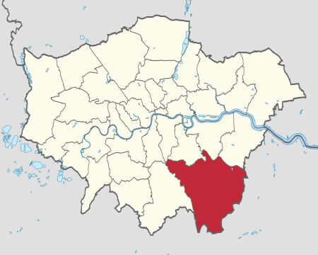
The London Borough of Bromley ( (listen)) is the southeasternmost of the London boroughs that make up Greater London, bordering the ceremonial county of Kent, which most of Bromley was part of before 1965. The borough's population is an estimated 332,336. It is named after Bromley, its principal town; other major towns are Penge, Hayes, West Wickham, Chislehurst, Beckenham and Orpington. The local authority is Bromley London Borough Council.
Excerpt from the Wikipedia article London Borough of Bromley (License: CC BY-SA 3.0, Authors, Images).London Borough of Bromley
Snag Lane, London
Geographical coordinates (GPS) Address Nearby Places Show on map
Geographical coordinates (GPS)
| Latitude | Longitude |
|---|---|
| N 51.333333333333 ° | E 0.083333333333333 ° |
Address
Snag Lane
Snag Lane
TN14 7RG London (London Borough of Bromley)
England, United Kingdom
Open on Google Maps


