Woodlands, Singapore
EngvarB from July 2014Malaysia–Singapore border crossingsNew towns in SingaporeNew towns started in the 1980sNorth Region, Singapore ... and 3 more
Pages including recorded pronunciationsPlaces in SingaporeWoodlands, Singapore

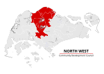
Woodlands ( (listen)) is a planning area and residential town located in the North of Singapore. As of 2019, the town has a population of 254,733. It is the densest planning area and is the regional centre for the North Region of the country. The Woodlands planning area borders Sembawang to the east, Mandai to the south and Sungei Kadut to the west. Woodlands New Town, which was developed during the 1980s, is situated within the Woodlands planning area. Woodlands also serves as one of the two land border connections on the Singaporean side between the countries of Singapore and Malaysia, called the Johor–Singapore Causeway, the other being the Tuas Second Link at Tuas.
Excerpt from the Wikipedia article Woodlands, Singapore (License: CC BY-SA 3.0, Authors, Images).Woodlands, Singapore
Woodlands Square,
Geographical coordinates (GPS) Address Nearby Places Show on map
Geographical coordinates (GPS)
| Latitude | Longitude |
|---|---|
| N 1.4362694444444 ° | E 103.78670555556 ° |
Address
Causeway Point
Woodlands Square
738099 , Woodlands
Singapore
Open on Google Maps


