Thamesmead
Areas of LondonDistrict centres of LondonDistricts of London on the River ThamesDistricts of the London Borough of BexleyDistricts of the Royal Borough of Greenwich ... and 2 more
Housing estates in the Royal Borough of GreenwichUse British English from September 2015

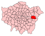
Thamesmead is an area of south-east London, England, straddling the border between the Royal Borough of Greenwich and the London Borough of Bexley. It is located 11 miles (18 km) east of Charing Cross, north-east of Woolwich and west of Erith. It mainly consists of social housing built from the mid-1960s onwards on former marshland on the south bank of the River Thames.
Excerpt from the Wikipedia article Thamesmead (License: CC BY-SA 3.0, Authors, Images).Thamesmead
Eastern Way, London
Geographical coordinates (GPS) Address Nearby Places Show on map
Geographical coordinates (GPS)
| Latitude | Longitude |
|---|---|
| N 51.504 ° | E 0.1261 ° |
Address
Eastern Way
SE2 9AN London (London Borough of Bexley)
England, United Kingdom
Open on Google Maps


