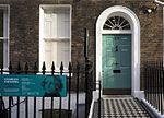
St Pancras, London
Areas of LondonDistricts of the London Borough of CamdenSt Pancras, LondonUse British English from September 2015

St Pancras () is a large district in north London. St Pancras was originally a medieval ancient parish and subsequently became a metropolitan borough. The metropolitan borough then merged with neighbouring boroughs and the area it covered now forms around half of the modern London Borough of Camden. The area of the parish and borough takes in the sub-districts of Camden Town, Kentish Town, Gospel Oak, Somers Town, King's Cross, Chalk Farm, Dartmouth Park, the core area of Fitzrovia and a part of Highgate. Broadly speaking, the names of the sub-districts are more widely used than that of the wider St Pancras area.
Excerpt from the Wikipedia article St Pancras, London (License: CC BY-SA 3.0, Authors, Images).St Pancras, London
Gray's Inn Road, London King's Cross (London Borough of Camden)
Geographical coordinates (GPS) Address Nearby Places Show on map
Geographical coordinates (GPS)
| Latitude | Longitude |
|---|---|
| N 51.5262 ° | E -0.1178 ° |
Address
Gray's Inn Road
Gray's Inn Road
WC1X 8UL London, King's Cross (London Borough of Camden)
England, United Kingdom
Open on Google Maps


