Hendon

Hendon is an urban area in the Borough of Barnet, North-West London 7 miles (11 km) northwest of Charing Cross. Hendon was an ancient manor and parish in the county of Middlesex and a former borough, the Municipal Borough of Hendon; it has been part of Greater London since 1965. Hendon falls almost entirely within the NW4 postcode, while the West Hendon part falls in NW9. Colindale to the north-west was once considered part of Hendon but is today separated by the M1 motorway.The district is most famous for the London Aerodrome which later became the RAF Hendon; from 1972 the site of the RAF station was gradually handed over to the RAF Museum. The railways reached Hendon in 1868 with Hendon station on the Midland Main Line, followed by the London Underground further east under the name Hendon Central in 1923. Brent Street emerged as its commercial centre by the 1890s. A social polarity was developed between the uphill areas of Hendon and the lowlands around the railway station.The source of the River Brent starts in Hendon and marks the local boundaries with Golders Green and Cricklewood. Hendon is located by numerous arbitrary roads, namely the A41, A406 (North Circular), the A1 and the M1 motorway. Today Hendon is home to rugby union club Saracens F.C. based at Copthall, and is also home to Middlesex University. It is represented in parliament by its namesake constituency which also includes Edgware and Mill Hill.
Excerpt from the Wikipedia article Hendon (License: CC BY-SA 3.0, Authors, Images).Hendon
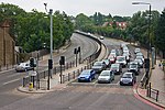
Wykeham Road, London Hendon Central (London Borough of Barnet)
Geographical coordinates (GPS) Address Nearby Places Show on map
Geographical coordinates (GPS)
| Latitude | Longitude |
|---|---|
| N 51.5837 ° | E -0.2252 ° |
Address
Wykeham Road
Wykeham Road
NW4 2TG London, Hendon Central (London Borough of Barnet)
England, United Kingdom
Open on Google Maps


