Ordsall, Greater Manchester
Areas of Salford

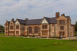
Ordsall is an inner city suburb of Salford, Greater Manchester, England. The population at the 2011 census was 14,194. It lies chiefly to the south of the A57 road, close to the River Irwell, the main boundary with the city of Manchester, Salford Quays and Manchester Ship Canal, which divides it from Stretford. Historically part of Lancashire, Ordsall was the birthplace of the bush roller chain and is home to Ordsall Hall.
Excerpt from the Wikipedia article Ordsall, Greater Manchester (License: CC BY-SA 3.0, Authors, Images).Ordsall, Greater Manchester
Phoebe Street, Salford Ordsall
Geographical coordinates (GPS) Address Nearby Places Show on map
Geographical coordinates (GPS)
| Latitude | Longitude |
|---|---|
| N 53.474 ° | E -2.278 ° |
Address
Phoebe Street
Phoebe Street
M5 3LD Salford, Ordsall
England, United Kingdom
Open on Google Maps


