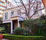
Potts Point, New South Wales

Potts Point is a small and densely populated area in inner-city Sydney, New South Wales, Australia. Potts Point is located 2 kilometres east of the Sydney central business district and is part of the local government area of the City of Sydney. Potts Point sits on a ridge immediately east of Woolloomooloo, west of Elizabeth Bay and Rushcutters Bay and north of Darlinghurst. The suburb has a roughly trapezoidal shape, and at its greatest extent is no more than one kilometre long by 200 metres wide. The suburb's boundaries include Macleay Street to the east, Darlinghurst Road to the southeast, William Street to the south, Brougham Street and part of Cowper Wharf Road to the west.
Excerpt from the Wikipedia article Potts Point, New South Wales (License: CC BY-SA 3.0, Authors, Images).Potts Point, New South Wales
Grantham Lane, Sydney Potts Point
Geographical coordinates (GPS) Address Nearby Places Show on map
Geographical coordinates (GPS)
| Latitude | Longitude |
|---|---|
| N -33.868055555556 ° | E 151.22416666667 ° |
Address
Grantham Lane
Grantham Lane
2011 Sydney, Potts Point
New South Wales, Australia
Open on Google Maps


